

Breck Fun Park :: Keystone Adventure Center :: Mnt Biking :: Breck Bike Bus :: Golf :: White Water :: Horseback :: Hiking :: Fishing :: Day Trips :: Jeep/ATV :: Balloon :: Scenic Drives
Breckenridge Summer Fun Park
The Breckenridge Fun Park will be open this year starting on Friday, June 15, and will run daily through Monday, September 3, and then also on Fridays-Sunday only from Sept. 7-16. Hours will be 9:30 am-5:30 p.m. and free parking will be available for guests in the Gondola parking lots. Free shuttle buses will begin service from the gondola lots staring June 15, and the BreckConnect Gondola will start running with FREE service on Saturday, June 16.
Get to Breck this summer for a ton of different activities, great dining options, and the gorgeous scenery that you know and love in Colorado!
Fun Park Day Ticket
The all-day Adult Fun Park Ticket includes unlimited use of the Gold Runner Coaster, SuperSlide, SuperPutt, Mountain Bike Park, Colorado SuperChair, Rockpile Climbing Wall, Mineshaft Maze, Pony Rides, SuperBungee Trampoline, Gemstone Panning, and Ripperoo’s Bounce House.
Adult Fun Park Ticket: $72
KIDS FUN PARK DAY TICKET
The all-day Kids Fun Park Ticket includes unlimited use of the Gold Runner Coaster, SuperSlide, SuperPutt, Mountain Bike Park, Colorado SuperChair, Rockpile Climbing Wall, Mineshaft Maze, Pony Rides, SuperBungee Trampoline, Gemstone Panning, and Ripperoo’s Bounce House. For kids 7 years old or younger.
Child Fun Park Ticket: $38
Gold Runner Coaster
Race down the mountain on 2,500 feet of elevated roller coaster track as you enjoy a thrilling journey around and through the forest on Colorado’s only alpine coaster! Ride single or with a friend, managing your own speed through the hairpin curves and twists!
Alpine SuperSlide
Choose from three different 2,600 foot long tracks and speed down the mountain on a variety of dips and banked turns!
Ages 7 & over may ride alone; ages 3-6 must ride with an adult.
Breck 4×4 Tours
Ride with up to 7 people in our open-air safari-style 4v4 vehicles up Peaks 8 & 7. This 90-minute ride will give you spectacular views from the top of the Ten Mile range. (Reservations recommended).
Tours will take place at the base of Peak 8.
Times: 10am, 12pm, 2pm, 4pm
BreckTreks Guided Hiking Tours
Team up with a Breckenridge guide for various routes of hikes on the mountain, where you will learn about Breck’s rich local history, wildflower identification and wildlife.
Pony Rides
New for this year, guests 65 lbs. and under can enjoy saddled pony rides in the specially constructed Breck Stables pony enclosure! It’s the perfect photo opportunity for the young cowboy or cowgirl in your family.
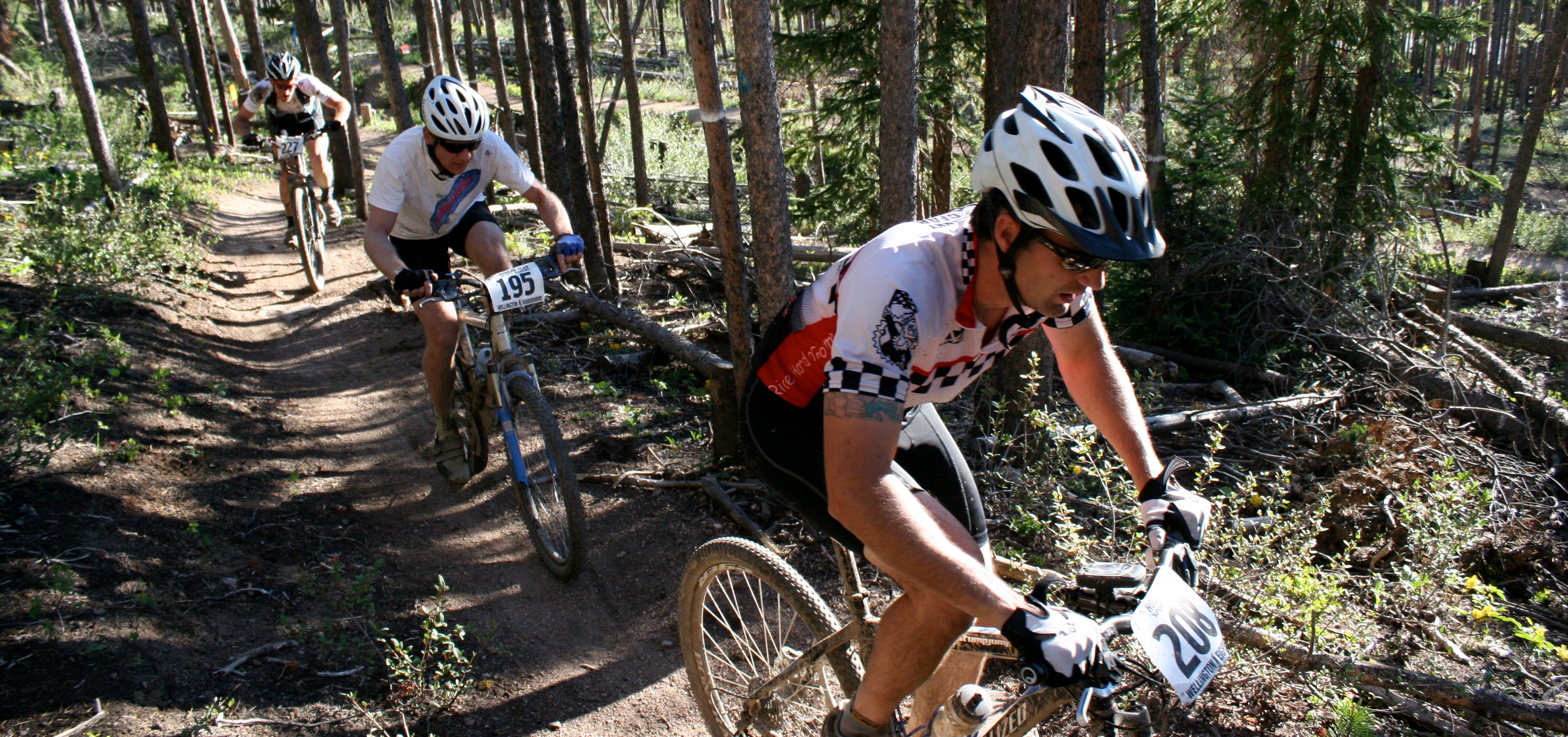
Mountain Biking
Sensational Rocky Mountain scenery and that famous Colorado sunshine make an irresistible combination for mountain biking. Breckenridge Ski Resort offers a wide network of trails for varying levels of difficulty with the convenience of lift access on Peak 8 via the Colorado SuperChair. *Rides may be subject to close at anytime.
SuperPutt Mini Golf
Come check what could possibly be the world’s most scenic miniature golf course. Kids & adults alike can take turns aiming for holes in one in this family friendly mini-course.
Free Scenic Gondola Rides
Park for free in the BreckConnect Gondola lots and enjoy spectacular views of Cucumber Gulch Preserve on your way up to the Breckenridge Fun Park!
Scenic Chairlift Rides
Ride to 11,059 ft. on the Colorado SuperChair for easy access to hiking and picturesque views of the Continental Divide. *Rides may be subject to close at anytime.
Gemstone Panning
The history of the gold rush comes alive with this attraction, which gives you the chance to pan for gems in this interactive sluice…keep what you find!
Breck Bark Dog Park
Bring Fido with you to the Fun Park! Dogs run free in our specially constructed dog run, located in viewing distance from all rides & activities.
Mineshaft Maze
Kids can try and beat the clock through Colorado’s largest human maze, winding their way through the wild and zany labyrinth of twists and turns.
Rockpile Climbing Wall
Test your rock climbing agility on our vertical climbing wall with various routes and levels of difficulty.
SuperBungee Trampoline
Kids & adults alike will flip for this attraction, as you get the chance to bounce and rotate up to 20 feet high in the air on this incredible trampoline experience.
Ripperoo’s Bounce House
Jump high into the air in our jumping castle. Let your kids expend some energy, as they can literally bounce off the walls in this inflatable bounce house.
Hours of Operation
Summer Operation Hours:
June 15 – September 3 from 9:30 AM – 5:30 PM
September 7 – 16: Fridays, Saturdays and Sundays only
(Dates & times are weather permitting)
Peak 8 Children’s Center
Drop off your children (2 months – 5 years) for fun activities, snacks, and lunch weekdays 8:00 AM to 4:00 PM. $20 an Hour; $75 Full Day. Reservations required.
*All Pricing, dates, and activities are subject to change.
Activity Ticket Summer 2012
Adult Fun Park Ticket $72.00
Senior Fun Park Ticket (70+) $38.00
Kids Fun Park Ticket $38.00
US Active Military Adult Fun Park Ticket $50.00
US Active Military Kids Fun Park Ticket $30.00
Hiking and Jeeps
Jeep Tour, 90 minutes $39.00
Adult Horseshoe Bowl Nature Hike $29.00
Adult Scenic Chairlift up-Slide Down Nature Hike $40.00
*Note some activities, such as guided tours, are not included in the activity ticket. Individual Fun Park rides & attractions can also be purchased on an a la carte basis; see ticket window for pricing & details
Mountain Dining
T-Bar – Located at the base of Peak 8, next to the Gondola and connected to the Ski Hill Grill. Open weekends in June, everyday July 1 – September 5, 11 AM until Gondola closes.
Join us for live entertainment, daily specials, corn toss and mini golf tournaments, and themed friday night happy hours!
Ski Hill Grill – Located at the base of Peak 8. Food and beverages are available for guest purchase during these hours. Come see us for burgers, hot dogs, homemade BBQ, and many other goodies.
Sevens Restaurant – Located at the base of Peak 7. Now serving lunch and dinner. Bring your dog for Happy Hour, daily from 3 – 6 PM. Canine inspired beer & wine are available, along with appetizer specials and complimentary doggie treats for your pet.
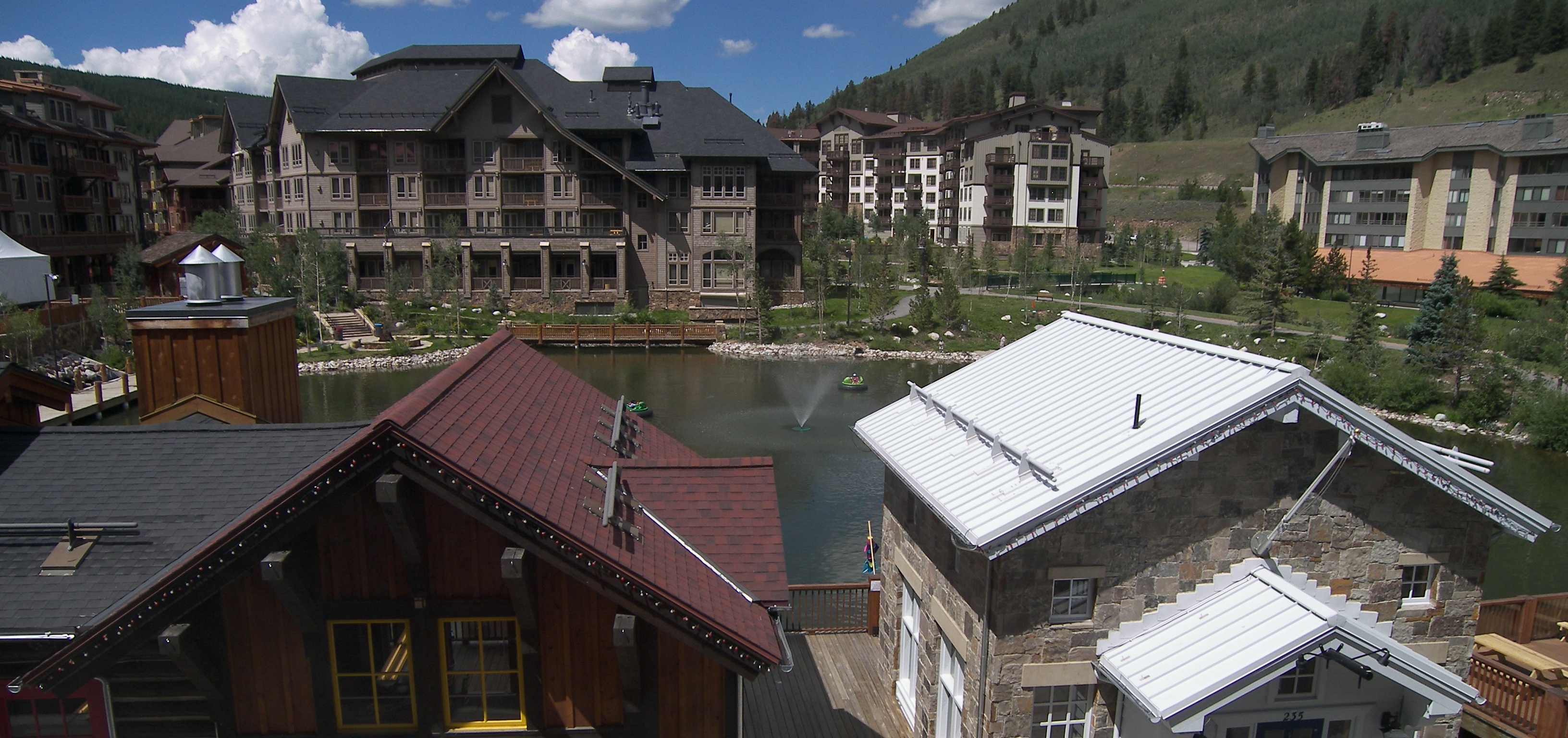
Keystone Adventure Center
The Adventure Center is the center for family activities, including paddle boating, kayak and canoe rentals, fish feeding and bike rentals. There is also an indoor arcade and food facilities. Or play volleyball or visit our tree house in the adjacent Decatur field. Free Wii rentals also available!
Type: Adventure, Kid Friendly, Outdoor, Groups, Grown Up, Free Activities
Location: Lakeside Village
Boat & Bike Rentals at Adventure Center
Cruise around on the Keystone Village Lake and share it with our feathery friends. Reservations are not required. Rentals are available at the Keystone Adventure Center.
Enjoy the great bike paths that travel throughout the county – peddle around Keystone’s Villages, on the bikeways around Lake Dillon, or on the world-renown trails throughout Keystone and Summit County. No reservations are required. Rentals (hybrid and single suspension bikes) are available at the Keystone Adventure Center in Lakeside Village. Full suspension bikes for use on Dercum Mountain are available only at Mountain Bike Headquarters in the River Run Village.
Adult Cross Country Trail Bikes:
| Bike per hour | $20 |
| Bike per 2 hours | $25 |
| Bike per half day | $30 |
| Bike per day | $36 |
| Multi-day | $30 |
Children’s Bikes:
| Bike per hour | $14 |
| Bike per 2 hours | $18 |
| Bike per half day | $21 |
| Bike per day | $23 |
| Multi-day | $21 |
Helmets FREE with any bike rental.
*Due to renovation improvements, water activities at the Adventure Center will not be available until July 2, 2014. The Adventure Center will open May 31, with bike rentals, in-door arcade, Wii rentals and food facilities. Decatur Field activities including volleyball, tree house and playground will be available starting May 31st.*
Boat Rentals:
| Paddleboats per half hour | $16 |
| Kayaks per half hour | $16 |
| Canoes per half hour | $16 |
| Stand-up Paddleboards per half hour | $25 |
PLAY WII FOR FREE
Practice your golf swing, zoom around an award winning race track, and play for match point in the comfort of the Adventure Center’s walls with FREE Wii interactive gaming system!
Practice your golf swing, zoom around an award winning race track, and play for match point in the comfort of the Adventure Center’s walls with FREE Wii interactive gaming system!Open 9:00am-7:00pm daily 6/29-8/189:00am-5:00pm Sunday – Thursday9:00am-7:00pm Friday – Saturday – Will be open till 7:00pm Friday, Saturday & Sunday 9:00am – 5:00pm daily
The Adventure Center is located in Lakeside Village, near the Keystone Lodge.
Call 800-354-4386 for more information.
HOURS OF OPERATION:
March 24 – June 27, 2014
Open 9am-5pm Daily
June 28 – August 17
Open 9am-7pm Daily
August 18 – October 5
Open 9am-5pm Daily
Labor Day Weekend
Parking for the Adventure Center:
22101 US Highway 6
Keystone, CO 80435Directions:
Park here and walk thru the Pedestrian Tunnel to the Keystone Lodge. Then walk down the stairs to the Lakeside Village plaza. The Adventure Center is on the southwest side of the lake.
Mountain Biking

Summit County Rides
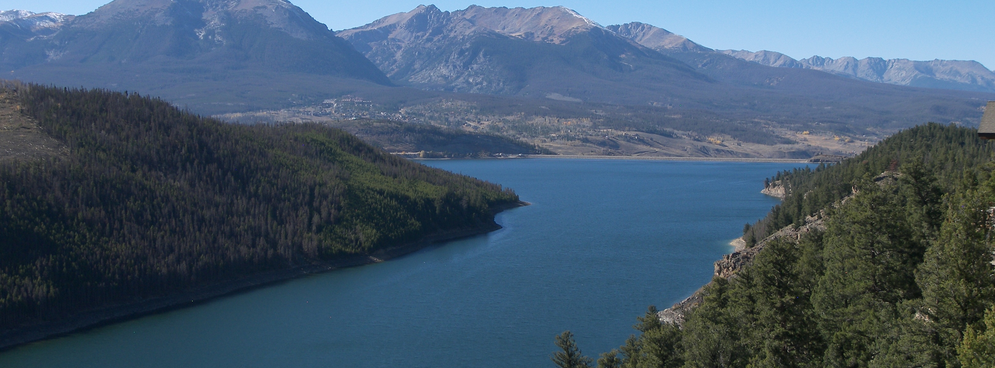
Summit County was organized as one of the seventeen original Colorado counties by the First Territorial Legislature on November 1, 1861. It was named for the many mountain summits in the county. Until February 2, 1874, its boundaries included the area now comprising Summit County, Grand County, Routt County, Moffat County, Garfield County, Eagle County, and Rio Blanco County. In 1883, Summitt County arrived at its present boundaries. Summit County covers 600 square miles with around three-quarters of it in national forest. That leaves around 150 square miles of private land. That means great riding!
Keystone Bike Park Opening Day Set for June 15, 2012
Keystone’s Park is nationally acclaimed as one of the best in the nation, including features like the Drop Zone, rock gardens, high-speed areas, daily terrain updates, not to mention some easier blue and green runs for those looking for a more laid-back downhill ride.
If you’ve never tried mountain biking, Keystone is a great place to learn. One major advantage of riding at the resort versus other trails around the county is the bike haul system. The lift will take you and your bike up to the top of Dercum Mountain, where you will be 11,640 feet in altitude and immediately hit by the amazing, panoramic views of surrounding mountains and Lake Dillon. The green hillsides make for a beautiful summer afternoon. Choose from miles and miles of varying trails that range from kid-friendly, beginner runs all the way up to extreme 22 foot drops and double black diamond trails that require full padding. Downhill mountain bike rentals are available throughout the River Run Village area.
Head to the park on the weekends and enjoy a beer, some food and live music at the Summit House, staying open until 7pm most Fridays and Saturdays. Here you can participate in FREE activities like horseshoes, bocce ball and ladder ball. The Friday Afternoon Club happens every Friday starting June 15 through August 31 and after 4pm, gondola rides to the top are free. (Does not include bike haul).
The Keystone Bike Park is set to open for the summer on June 15, 2012. Season Passes for the park are available, along with multi and single day options, with pricing as follows:
1 Run: $23 Adults, $11 for Children (Ages 5-12)
1-Day Pass: $37 Adults, $21 for Children
2-Day Pass: $70 Adults, $38 for Children
3-Day Pass: $96 Adults, $48 for Children
Season Passes:
Keystone Only Unlimited: $299
Keystone Only Unlimited with Winter Season Pass: $249
Keystone Only 5-Pack (Must purchase by 6/30): $139
Typical hours for the the bike park will be from 10am to 7 pm on weekends, and 10am-5pm Monday through Friday.
Alpine Sports
Alpine Sports is a locally owned and operated full service bike rental and repair shop with 4 locations in Breckenridge. See the store locator for a town map.
We are proud to take care of all your rental bike needs.We have a huge selection of NEW rental bikes from Specialized for the whole family. Whether you are looking for a cruisy bike ride down Vail pass with the family or an Extreme mountain bike experience, we have a ride for everyone.
And don’t forget to ask about our Vail Pass Bike Shuttle – Have Alpine Sports take the whole family to the top of Vail Pass and cruise 14 miles downhill on a paved bike path all the way to Frisco. This is a great day adventure for all ages and abilities.We look forward to seeing you soon at Alpine Sports.
Pioneer Sports
Pioneer Sports has a wide range of rental bikes to choose from. For the leisure rider, we offer Giant Sedona path cruisers, as well as tandems from Sun Bicycles. All of our bikes are expertly maintained and include gel seats, riser handlebars and frame sizes from 13.5 inch to 21 inch to suit every rider and make your ride through the Rockies more enjoyable.
For those looking for a true Colorado road bike experience we offer the fast and light Giant Defy. For the more adventurous rider looking to get off the pavement and onto the trails, we offer the full suspension Trance x2 mountain bikes from Giant. And so the little ones can join in on the summer fun, we offer 20 and 24 inch front suspension children’s bike rentals, as well as Burley trailers and Trailer Bike attachments.
Bike Bus – Breckenridge

Call 888.700.2754 ext 100 to reserve your seat today

The Breckenridge BIKEBUS is not a bicycle
built for two – it’s a bicycle built for 16. That’s right – 16 people ride on the BIKEBUS — ten pedalers, 5 freeloaders who sit in the non-pedaling seats and a biketender/server that you designate from your group who stands in the center. There are several stops along the route so you can also switch positions along the way from time to time.
Motor? – we don’t need no stinkin’ motor! The BIKEBUS is human powered by you, the rider. It’s a green machine that reflects the healthy biking culture of Breckenridge and Colorado.
We supply a driver who brakes and steers. You are the engine. Our maximum cruising altitude is 9600 feet. Our maximum cruising speed is 5-7 mph. Fun, not fast.
We are fully insured and we are fully permitted by the Town of Breckenridge.
The Breckenridge BIKEBUS offers:
Coolers for any beverages that you bring along.
Cupholders for your beverage
A Bose SoundDock to play your favorite tunes (or you can choose to play our playlist of over 100 bicycle-related songs).
On board snack and beverages for purchase
Local discounts at area bars and restaurants
Storage on board for your belongings
A safe and fun lighting system
We offer a vast variety of fun excursions including (but not limited to):
Town Tours
Progressive Dinners
Pub Crawls
Family Fun And Family Reunions
Corporate Events/Team Building
Charity Events And Fundraising
Church Gatherings & Outings
Company Outings
Sports Team Gatherings
Picnics
Breakfast/Coffee Crawls
Ladies Night Out/Guys Night Out
Annual Events, Festivals, Parades
Progressive Dinners
Retirement Parties
Singles Mixers
Pub Crawls
Wine And Cheese Crawls
Field Trips
Wedding Party Excursions
Bachelor/Bachelorette Parties
Parades
Tailgates
Sporting Events
Special Events
Promoting Something
Game/Game show excursions
Poker/Card Game excursions
Comedy/Open Mic excursions
Our route begins at the north end of Main Street near City Market and cruises the entire one mile length of Main Street where we turn around on south Main Street and return North for the same mile to our starting point near City Market .
Main Street is beautiful during the day and dazzling at night and we will be happy to pause at any stops that you might request along the way, provided that it is a safe stop and doesn’t interfere with traffic.
In addition to our main street route, we can also transport the BIKEBUS to other locations you might have in mind and run custom excursions for you for special events and gatherings that you may have in mind. Please keep in mind that you may need to obtain special local permits and permission for these type of excursions.
So jump on and join the fund – go to our booking page and reserve your excursion on the Breckenridge BIKEBUS today !
WHO DRIVES THE BIKEBUS?
We provide a pilot who steers and brakes the vehicle, so you can relax and have fun!
CAN YOU DRINK ALCOHOL ON THE BIKEBUS?
Not legally.
HOW MANY PEOPLE RIDE/PEDAL?
The BIKEBUS can carry up to 16 people. There are 5 seats with pedals on each side plus the 2 non-pedaling seats above the back wheels. There is a bench that seats 3 plus one “standee” spot in the middle for the person that you designate as the biketender/server.
WHAT IS THE LEAST AMOUNT OF PEOPLE REQUIRED TO RIDE THE BIKEBUS?
It takes about 4-6 riders to propel the BIKEBUS.
WHAT IS THE BIKEBUS ROUTE?
The BIKEBUS route runs south from the north end of Main Street (near City Market) to Main Street Station at the south end of Main street where we turn around and head back to our starting point. It’s a 2 mile round trip – one mile down Main street and then one mile back up.
Depending on the excursion, we may make several stops along the way at various establishments for food and/or drink or for a historical tidbit or two about the town.
CAN THE BIKE BUS GO UP HILLS?
We can go up small hills.
CAN I MAKE MY OWN ROUTE FOR THE BIKEBUS?
In addition to our main street route, we can also transport the BIKEBUS to other locations you might have in mind and run custom excursions for you for special events and gatherings that you may have in mind. Please keep in mind that you may need to obtain special local permits and permission for these type of excursions.
WHERE DO WE START AND END THE TOUR?
We start and end our excursions at the same place – at the north end of Main Street, near City Market.
DOES THE BIKEBUS SUPPLY FOOD AND DRINKS?
We sell some light snacks and bottled water on the BIKEBUS. You are also welcome to bring your own food and beverages. We have coolers on board to store your stuff.
HOW DO I PAY?
You can pay via our website using paypal, with cash or with credit card. You can also pay the driver.
CAN I CANCEL/RESCHEDULE?
If you cancel 30 days or more before your excursion, you have the option to receive a refund of 50% or a rain check that is valid for the rest of our operating season.
If you cancel with less than 30-15 days before your excursion, you will receive a rain check that is valid for the rest of our operating season.
If you cancel with less than 15 days before your excursion, you will receive our sympathies.
WHAT ARE THE HOURS OF OPERATION?
Your hours are our hours – in other words, we will run a ride or excursion whenever someone wants to book it, based on availability.
HOW FAST DOES THE BIKEBUS GO?
Up to 8 mph
WHO SHOULD RENT THE BIKEBUS?
People who want to have a fun, inexpensive and unique experience while in Breckenridge. People who want to do…Town Tours, Progressive Dinners, Pub Crawls, Family Fun And Family Reunions, Corporate Events/Team Building, Charity Events And Fundraising, Church Gatherings & Outings, Company Outings, Sports Team Gatherings, Picnics, Breakfast/Coffee Crawls, Ladies Night Out/Guys Night Out, Annual Events, Festivals, Parades, Retirement Parties, Singles Mixers, Wine And Cheese Crawls, Field Trips, Wedding Party Excursions, Bachelor/Bachelorette Parties, Parades, Tailgates, Sporting Events, Special Events. People who want to Promote Something.
WHO SHOULD NOT RENT THE BIKEBUS?
People who don’t like fun, the outdoors, a little exercise. People in the witness protection program who don’t want to be noticed.
WHAT KIND OF WEATHER DO YOU OPERATE IN?
Rain. Shine. Cold. Warm. However, we will not operate if there is a hurricane, tornado or a flood or avalanche that destroys Main Street. We reserve the right to cancel an excursion if the weather is too crazy and provide a rain check. We do not issue rainchecks once an excursion has begun. We will most definitely cancel an excursion in the event that it rains frogs it should appear to be end of the world.
WHAT IF WE WANT TO EXTEND OUR EXCURSION TIME?
We will be happy to extend your excursion time if there are no excursions booked right after yours. Our standard hourly rates apply. However, if there is an excursion right after yours, we cannot extend your time and you will be charged a late fee if you do not return the BIKEBUS to the starting point on time. The time it takes to complete a tour is up to the people pedaling. The driver does not have pedals.
WHAT IS THE BIKEBUS SEASON?
We plan on operating from May through October. But if a nice day presents itself before May or after October (as it often does in Colorado), we will be happy to entertain an excursion.
WHO CAN RIDE ON THE BIKEBUS?
Anyone can ride on the BIKEBUS but keep in mind that ten people will be pedaling and they should fit enough to do so. Also, we are limited in how much we can adjust the seats so some smaller riders may not be able to pedal. Five people get to sit without pedaling and one person gets to stand. The rest of us get to make fun of you so we also advise that you have the emotional strength to take it.
WHY DO I NEED TO SIGN A WAIVER AND WHY DO YOU OFFER A HELMET
Like any other bike, the BIKEBUS is not without danger – small possibility of danger, but a possibility nonetheless. For that reason, we offer helmets if you should want to wear one to protect your pretty lil’ brain. You don’t have to wear a helmet but you have the right to one if you want it and the right to decline one if you don’t. By signing the waiver you are saying that you are responsible (not us) if you hurt yourself.
HAVE ANY BIKEBUS RIDERS EVER BEEN INJURED?
We have never had even one injury on the BIKEBUS other than people complaining that their facial muscles hurt from laughing. In all of these type of vehicles in all of the world, there was only one incident in Europe where a person decided to jump off the vehicle while it was moving, resulting in a broken ankle. Like I said in the last answer – our passengers have brains and they use them.
THE BIKEBUS IS AVAILABLE FOR:
- Town Tours
- Bachelor/Bachelorette Parties
- Progressive Dinners
- Pub Crawls
- Family Fun And Family Reunions
- Corporate Events/Team Building
- Charity Events And Fundraising
- Church Gatherings & Outings
- Company Outings
- Sports Team Gatherings
- Picnics
- Breakfast/Coffee Crawls
- Ladies Night Out/Guys Night Out
- Annual Events, Festivals, Parades
- Retirement Parties
- Singles Mixers
- Wine And Cheese Crawls
- Field Trips
- Wedding Party Excursions
- Parades
- Tailgates
- Sporting Events
- Special Events
- Promoting Something
- Game/Game show excursions
- Poker/Card Game excursions
- Comedy/Open Mic excursions
Golf
Copper Creek


 A mix of links and mountain style holes designed by the venerable Pete and Perry Dye, Copper Creek accommodates the novice golfer from the forward tees while still providing a great test for the accomplished golfer. Spellbinding views of the 10 Mile Range provide the perfect backdrop for any golf outing and Copper Creek’s outstanding service is sure to impress.
Copper Creek was awarded 3.5 stars (out of 5) from Golf Digest in its 2000 – 2001 places to play guide.
The front nine winds through natural alpine terrain, towering pines, numerous lakes and streams, all leading to rolling emerald greens that demand your best concentration. The back nine changes in character as the fairways cut through the forest and the scant remains of a 19th century mining town. Pete and Perry Dye’s incorporation of the natural alpine terrain, unique use of railroad tie bulkheads and elaborate mound systems present you with thought-provoking challenges and scenic pleasures.
Breckenridge Golf Club


 The Town of Breckenridge can boast that it is the only municipality in the world to own a Jack Nicklaus designed, 27-hole golf course. The course opened for play in 1985. During the summer 2001 golf season, the Town opened another nine holes also designed by Nicklaus and every bit as challenging as the original 18-holes. The new Elk nine as it is named, offers more elevation change than the Bear and Beaver nines.
Since the opening of the course, national and regional honors have been bestowed on Breckenridge. Honors awarded by the Colorado Golfer (the State Golf Newspaper) have included; Best Mountain Course, and Toughest Mountain Course. Golf Digest “Places to Play” rates Breckenridge as a 4 -Star Award Winner, and as one of their top “Upscale Places To Play” in the nation. The course is also Zagat rated.
The golf course is situated in a beautiful mountain valley. The clubhouse sits at an elevation of 9,324 feet. At this elevation the golf ball flies farther and straighter than at lower elevations, as there is less air resistance. The air not only allows you to hit the ball farther, but also offers temperatures that make you forget about the heat of the summer. Typical daytime summer temperatures range from 65 degrees to 80 degrees. Quite rarely will the temperature exceed 80.
The course has four sets of tees so that each golfer may select the challenge equal to their game. From the Nicklaus Tees on the Elk / Beaver rotation, the course plays 7,145 yards and has a course rating of 73.5 with a slope rating of 151. This set of tees has the second most difficult course rating in the state. A challenge for even the best golfer. Each set of tees plays to a par 72
Keystone


 Two amazing Colorado golf courses. Thirty-six incredible, championship holes. These have made Keystone one of the nation’s most respected golf resorts. Imagine teeing off what is seemingly the edge of the world, launching your ball into the light, clear, Rocky Mountain air. At Keystone, you’re in for some of the greatest golfing of your life…in one of the most spectacular settings you’ll ever experience.
Keystone Ranch
Challenge yourself and take your game to a higher level on this classic mountain golf course. Winding through lodgepole pines, around sage meadows and across a nine-acre lake, this par-72 golf course features slight elevation changes and many bunkers. Designed by Robert Trent Jones, Jr., Keystone Ranch Golf Course follows the legendary links-style of a Scottish course on the front nine, while the back nine presents a traditional mountain valley layout. Total yardage is 5,582 – 7,090.
“We use our vision to reveal and sculpt the course inherent in each site so golfers can enjoy the challenges and wonders of the game.” – Robert Trent Jones, Jr
The Keystone Ranch clubhouse features lockers rooms and a fully-stocked golf shop offering signature golf apparel, golf clubs, and accessories from top manufacturers. Keystone Ranch Restaurant serves breakfast, lunch and apres golf food and beverages every day during the golf season. Enjoy some of the best views in Summit County on our deck overlooking the back nine.
Practice facility access and practice balls are included in the golf fees for all guests. Our practice facility includes a putting green, practice bunker, and driving range.
The Keystone Ranch Restaurant
Experience our extraordinary fusion of the Colorado frontier and fine dining in the rustic elegance of this original 1930s ranch homestead overlooking the Keystone Ranch Golf Course. Meander through a luxurious six-course dinner featuring excellent Colorado cuisine and wild game specialties. Or choose our four-course dinner for two for $99. It won’t take long to see why the Ranch is a AAA Four Diamond™ restaurant and a Wine Spectator DiRoNa winner, as well as recognized as one of the Best Restaurants in Colorado by the prestigious Zagat Survey®. Reservations are required. Call 800-354-4FUN (4386) for reservations and info.
The River Course
This par-71, Hurdzan-Fry course brings an element of drama to your game. The par-35 front nine is oriented around the path of the Snake River and the par-36 back nine winds through a lodgepole pine forest. Impressive elevation changes, variable bunkers, water hazards, and five sets of tees on each hole combine to challenge golfers of all abilities. The 16th hole features a 194-foot elevation drop from tee to green and the scenic 18th hole offers 12 bunkers and spectacular views of Lake Dillon. Add to that the magnificent views of snow-capped peaks and wildlife and it’s easy to see this is a golfing experience unlike any other. Total yardage is 4,762 – 6,886.
“Our philosophy is to design golf courses that stir the spirit, exceed expectation and defy understanding. In doing this, golf becomes a complex puzzle requiring strength, skill and strategy – set in an environment of unquestioning beauty, yet subject to the irrepressible forces of nature.” – Dr. Michael Hurdzan
The River Course clubhouse features the Golf Shop and The Grill. Our golf shop is fully-stocked with signature golf apparel, golf clubs, and accessories from top manufacturers. The River Course Grill is open daily during the golf season for breakfast, lunch, and apres golf – come by after your round for a happy hour drink at the bar or on our sunny patio.
Practice facility access and practice balls are included in the golf fees for all guests. Our practice facility includes a putting green, practice bunker and driving range.
Raven Golf Club
The #1 Colorado golf course, the Raven Golf Club at Three Peaks, is located in the majestic Gore Mountain Range of Colorado and offers panoramic vistas at every turn. The golf course offers an appealing blend of traditional and contemporary architectural design styles.
Routed through towering Colorado pines, quaking aspens, crystal clear creeks and trout filled lakes; the golf course overloads the senses with the mountain beauty of Colorado.
Yardage Guide
Tees Yardage Rating Slope
Black Tees 7413 73.8 135
Silver Tees 6806 71.4 133
White Tees 6386 69.7 123
Gold Tees 5235 69 129
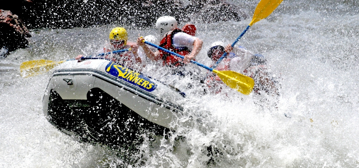
Colorado White Water Rafting
Rafting In Colorado
 Rafting in Colorado is one of the many exhilarating outdoor activities available to residents and visitors of this beautiful state. Colorado is one of the rare states that allows a person to really enjoy multiple outdoor experiences to the fullest. Beautiful mountain views, frequent wildlife spotting, and an endless amount of outdoor activities provide a healthy environment that attracts people from all over. One of the most popular outside adventures that this state has to offer is rafting on Colorado’s exciting
 white water rapids on the Arkansas River. Rafting in Colorado is an unforgettable experience, whether for a family, individual, or corporate group.
Colorado white water rafting trips are available for all skill levels and ages through American Adventure Expeditions. Whether you and your family want to enjoy a more relaxing Colorado rafting experience while animal spotting along the way, or for an adrenaline junkie who is looking for the ultimate rafting in Colorado adventure, everyone is sure to have an experience to remember forever.
 Maybe the best feature that makes Colorado rafting so enjoyable is the chance to float in between a canyon that stands over 1,000 feet above your head on our Royal Gorge rafting trip. The rush you feel from battling white water combined with this outstanding canyon surrounding you creates a feeling of excitement that simply cannot be found through anything else. American Adventure offers other trips down the Arkansas River including Browns Canyon, The Numbers and more! Rafting in Colorado is its own unique adventure and our experienced Colorado rafting guides and staff are sure to make your day one to remember forever.
Arkansas River Rafting – A Lifetime of Memories
If you’re looking for a unique way to enjoy the beautiful Colorado landscape along the Arkansas River, or if a thrilling Colorado whitewater rafting adventure is what you have in mind, we have it all! As the only outfitter with 2 riverside facilities (one in Buena Vista, one in Canon City), AAE allows you to create your very own Arkansas River rafting trip.
Families love us for our scenic and kid-friendly trips, while hardcore rafting fans can’t get enough of our extreme adventures, where whitewater meets white knuckles! For over 23 years, American Adventure Expeditions has been committed to ensuring that each and every Colorado rafting experience with us is of the absolute highest quality. Your safety, comfort, and enjoyment are our top priorities. Our first-class riverside facilities, top of the line equipment and unmatched dedication to customer service are what truly set us apart from other Colorado rafting outfitters.
Rafting Trips Near Buena Vista and Canon City
The section of the Arkansas River that you choose to raft will depend on your taste in whitewater, your location, and how much time you have. No matter which Arkansas River rafting trip you choose, we at American Adventure Expeditions will go out of our way to provide you with an amazing whitewater rafting experience and memories that will last a lifetime!
Day Trips on the Arkansas River (near Buena Vista and Canon City) are perfect for those of you who are looking for a Colorado whitewater rafting adventure but have other things included on your vacation itinerary. Pack in as much scenery, wildlife, and Colorado whitewater as possible into your trip; no matter how much (or how little) time you have to spend on the river.
Overnight Trips. The only complaint you’ll ever have about our overnight rafting adventures near Canon City is that they’re just not long enough! The Arkansas River boasts over 100 miles of raftable Colorado whitewater and as hard as we’ve tried, when you can’t fit enough into a day. Thus, the Overnight Trip.
Royal Gorge White Water Rafting
Royal Gorge rafting is one of the most popular white water excursions in the Colorado area. This exciting Colorado rafting trip is known for the remarkable views, rushing currents, and for passing beneath the world’s highest suspension bridge. Royal Gorge white water rafting is a perfect way to truly experience Colorado’s wondrous outdoors and is an adventure to remember for a lifetime!
Royal Gorge white water rafting is exactly what you think of when you think of whitewater rafting in Colorado! Imagine rafting through incredible white waters- getting splashed from head to toe. To your left and right are huge canyon walls that tower 1,100 ft over your head. Suddenly, a massive bridge appears straight up as you work your way through the exciting rapids. This is what you can experience through our incredible Royal Gorge rafting adventures.
Colorado is one of the best places to encounter exciting white water rafting excursions, and this unbelievable Royal Gorge white water rafting adventure is considered to be among the best. Book a solo trip, or bring your friends. All we ask is that you come ready to gain the memory of a lifetime! Contact American Adventure today to book a Colorado rafting vacation to remember forever.
Canon City Rafting
Canon City rafting has never been better! Canon City is one of the best locations to go whitewater rafting in Colorado and American Adventure Expeditions knows just where to take you. The Arkansas River is home to some of the greatest rafting runs in Colorado, many of which can be found in Canon City. Let us take you of a trip that you’ll remember for a lifetime.
Bighorn Sheep Canyon rafting is one of our more popular trips and is located just west of Canon City. This beginner/intermediate rafting adventure has it all…allowing you to experience the thrill of white waters while being able to catch a glimpse of Colorado’s beautiful bighorn sheep that can be found along the mountainside. Bighorn Sheep Canyon is one of the many runs that makes Canon City rafting so much fun.
Another popular rafting run that departs just west of Canon City is our exciting Royal Gorge rafting trip. This intermediate/advanced run entails big rapids, unbelievable views, and steep drops that makes this trip perfect for a person looking for a more thrilling adventure- just be prepared!
American Adventure Expeditions has an outpost located Canon City and we are ready to show you the Colorado rafting experience of a lifetime. Our skilled guides will take you Canon City rafting like never before, so get ready for a wild ride.
Buena Vista
Buena Vista rafting allows you to experience Colorado’s white waters at it’s best and American Adventure Expeditions wants to be your guide! Buena Vista, Colorado is home to some of the best white water rafting runs in the state. Two of the most popular sections, The Numbers and Brown’s Canyon, allow you to experience Colorado rafting to the fullest.
The Numbers rafting is considered one of the most popular advanced runs that Colorado has to offer. This white water rafting adventure entails steep and technical drops, narrow channels, and continuous action all throughout the trip. It is considered to be one of the most demanding- so make sure you are prepared for a wild ride. For those seeking a true adrenaline rush, this is the rafting trip for you. The Numbers rafting trips depart from our headquarters located 2 miles south of Buena Vista. If you are looking for a truly exciting Buena Vista rafting adventure, look no further.
For the person seeking a beginner/intermediate trip, Browns Canyon is the run for you. Many people consider Brown’s Canyon rafting to be one of the best white water rafting sections worldwide. The exceptional combination of beautiful Colorado scenery and fun-filled white waters make this Buena Vista rafting trip one to remember. Our Brown’s Canyon rafting trips also depart from our office located 2 miles south of Buena Vista, Colorado.
American Adventure Expeditions wants to show you Buena Vista rafting at it’s best. As an experienced and professional outfitter, we provide an unbeatable environment for Colorado rafting. Book your trip for The Numbers or Brown’s Canyon and prepare yourself for an exciting adventure. With American Adventure Expeditions, Buena Vista rafting has never been better.
Possible Tour Guides
 American Adventure
Breckenridge White Water
Clear Creek Rafting
Colorado Rafting
Kodi Rafting
Raft Masters
Royal Gorge Rafting
Performance Tours
Colorado By Horseback
Colorado Horseback
To experience Summit County on horseback is to see the mountains and terrain as the original pioneers once did. Settlers and prospectors began arriving in Colorado in the late 1850s before roads or even well beaten paths even existed. These settlers cut through the forests and across rivers the same way visitors can today, on the backs of nature’s most majestic creatures – horses.
The wide lands of Colorado ranches allow riders to see the grand sweep of the beautiful scenery and feel the overwhelming presence of open sky and huge mountains. Ranches throughout the Summit County area have many riding packages available in a variety of formats and destinations. Complete a vacation with a trip through time and nature on horseback, guaranteeing the experience to be one which the entire family will adore.
Possible Tour Guides
Keystone Stables: Horseback Riding
Saddle up for a guided horseback ride through the White River National Forest. Minimum age 8 years. Guests are placed on a horse appropriate to their riding experience. An experienced wrangler will lead guests and share the history of the area. No riding double.
Reservations required – call 800-354-4386. Day of reservations available.
Dates: June 6 – September 1, 2014. Limited Service September 3-22, 2013
Price and Time:
| Duration | Price | Start Times |
| 1 Hour | $47 | 8:30am, 10:30am, 12:00pm, 1:30pm, & 3:00pm |
| 2 Hour | $69 | 9:00am & 1:00pm |
| 1/2 Day | $132 | 8:00am |
Lunch available at the Giddy Up Grill 11am-1pm on Saturdays and Sundays starting June 15 through August 25.
Meeting Location:
1 Hour meets at Soda Ridge Stables
2 Hour meets Highway 6 Stables
4 Hour meets Highway 6 Stables
Additional Info:
Wear pants (no shorts)
Wear closed toed shoes
Suggested that you bring a jacket
Pony Rides
Kids ages 3-7 will love a pony ride as their parent leads the pony around the corral.
Price: $15
Time: 10:00 am to 3:00 pm daily. No reservations needed.
Dates: June 17 – September 1, 2014
Draft Horse Driving Clinic
Join a Keystone Wrangler Wednesday’s at 4 PM for an hour long clinic. Learn verbal commands as you are placed in the driver’s seat for a chance to drive one of the Keystone Draft Teams around the arena.
Dates: Wednesdays, June 6 – August 21, 2014
Time: 4:00-5:00pm every Wednesday
Cost: $11 per person
Age Requirements: 8 years or older to drive.
Wild West Nights
Bike, hike or gallop over to the Keystone stables for Wild West Nights every Tuesday at the Keystone Stables.. The fun starts at 5 pm with a bike-in movie, brats & beverages available at the Giddy Up Grill. Try your hand at horseshoes or lassoing while enjoying FREE S’mores around the campfire. Everyone is invited to hang out around the camp fire and enjoy the sunsets form the Stables vantage point. No charge just to tour the Stables and hang out by the fire.
Dates: Every Tuesday, June 18th – August 6th.
Time: 5pm- 8pm
Cost: FREE
Scenic Wagon Ride
Relax and enjoy a 60 minute scenic horse-drawn wagon ride through Soda Creek Valley to Keystone’s original homestead. Wranglers will give an historic account of Keystone’s original settlement and progression to a ski resort. Learn about the horses pulling the wagons and even stop for a cool refreshing beverage at the original Keystone homestead. Reservations are required – call 800-354-4386.
Price:
Adults (13+): $22
Children (4-12): $16
Meeting Time:
3:00 p.m, Everyday but Sunday and Wednesdays.
Closed Sundays and Wednesdays (exceptions made for larger groups on a case-by-case basis)
Wagon Ride Dinner
Meet at the Keystone Adventure Center in Lakeside Villageand take a 15 minute shuttle to the back ranch property and board hay free horse drawn wagons. Enjoy a 30 minute ride in a hay-free wagon through a remote valley to a historic ranch homestead while your wrangler explains the history of the area and introduces you to the horses too. Dinner is served outside, except during rain or snow storms when it is served under our tents. This activity goes out regardless of weather. Dinner is served buffet-style: garden salad, grilled BBQ chicken, smoked ribs, corn on the cob, Durango beans, corn bread muffins and apple pie a la mode. Vegetarian option is Boco Burgers instead of chicken or ribs. All non-alcoholic beverages are included in the price. Liquor, beer and wine is available for an additional fee. Enjoy live music from a guitar player while you dine. Included are horse shoes, cattle roping and a fire pit (unless there is an open fire ban for the area) A Unique Keystone Resort dining experience!
Price
Adults (13 and above): $64
Children (6-12) $32
Children (3-5) $16
Infants (3 and under): Free with paying adult
Dates and Times
June 13 – September 1, 2014. Limited availability after Sept. 2.
Meeting
Meet at 4:30 p.m. – Shuttle to Wagons departs at 5:00 pm, return to Adventure Center at 8:00 p.m
Meet at Activities & Dining desk in the Adventure Center located at Lakeside Village
Hiking
Pick from our list of different trails below for complete descriptions! There are a large number of trails nestled within the backcountry of Summit County. From beginner walks for the whole family to more advanced trails which crest the summit of Colorado’s 14,000 ft. peaks, Summit County Explorer provides descriptions and difficulty ratings for each of these trails. These trails have been rated beginner, intermediate, and advanced. Please select the appropriate level for an in-depth description of the trails based upon our personal hiking experiences as well as photos of the beautiful scenery you can expect to view. Difficulty Levels Each hiking trail is assigned a level of difficulty from beginner to advanced. Beginner hiking trails are usually pretty level and clearly marked trails of shorter length, suitable for family and children. Select from the list of trails below for a complete description and photo tour!
Loveland Pass
Length: Approx. 3 miles round trip Highlights: Spectacular scenery, the Continental Divide, alpine hiking Difficulty Rating: Beginner Elevation Gain: Approx. 450 ft.
Highlights: Spectacular mountain scenery, the Continental Divide, alpine hiking!
Directions: Take route six out of Silverthorne through Keystone to the Loveland Pass summit. Park in the marked area on your right and walk across the road and begin your hike by climbing the steps on the left.
Description: For all around mountain grandeur and easy acess, this hike is hard to beat. The steps will lead to a ridge that follows the Continental Divide as it ascends to a high point of about 12,500′ to the northwest. As you proceed along the ridge, the trail divides – you can take either fork but if the snow cover is deep you may want to stay to the left and keep on the higher ground as you follow the ridge line.
As you experience the exhilaration of hiking above the tree line, you will be thrilled by awesome views in every direction. Look for Arapahoe Ski area off to the south and Loveland Ski area to the west. To the northeast, you’ll see Mt. Sniktau which can be reached via the trail that ascends from the parking lot below.
After about a mile and a half, you’ll encounter a short rock scramble that leads to a wind shelter that marks the highest point of the Divide. This is a great place to enjoy lunch and the views. When finished you can complete a loop by gradually descending east and continuing back to your starting point.
Generally, we find the experience of hiking the Divide to be so invigorating we prefer to retrace our steps – I guess SCE just like to “be (and stay) on top”! The unparalleled views and the crisp mountain air are sure to turn any first-timer into a repeat visitor and outdoor enthusiast.
Salt Lick Trail
Length: Approx. 4 miles (add a mile if you continue on to Lily Pad Lake) Highlights: Mountain views thick aspen and pine forest Difficulty Rating: Beginner Elevation Gain: Approx. 650 ft.
Directions: Exit I-70 at Silverthorne (exit 205) and take route 9 north to the wilderness Road (across from Wendy’s) turn left onto wilderness and continue for .9 miles and turn left on to a dirt road that is located on a sharp curve just as you pass the wilderness Center (Conoco station). Park here and follow the road to the trailhead. Description: Follow the trail for about 15 minutes until you see a log bridge on your left that crosses Salt Lick
Creek. Cross the bridge and continue up the path past beaver ponds and open meadows and a sign that marks the entrance to the Eagles Nest Wilderness area. If you miss the first bridge, there is another a couple dozen yards ahead – you can cross here.
Be sure to cross Salt Lick Creek however, because if you continue up the road on the right of the creek you will eventually enter a subdivision of condos where you may pass your time attending open houses rather than enjoying an exhilarating hike.
Once you cross into the Eagles Nest Wilderness area the ascent becomes a bit more steep as you pass through a thick pine and aspen forest to the junction of the Lily Pad Lake trail.
Lily Pad lake is about a half mile from this point so if you continue on you will add about one mile to your hike. (see Lily Pad for more info) The cool days of autumn are best for enjoying the spectacular aspen and scenery of this trail.
A golden carpet of Aspen leaves covered the trail during our recent fall outing here.
 Mesa Cortina Trail
Length: 5.2 miles (round-trip) Highlights: Spectacular aspen and lodge pole forest, sage brush meadows, views of Lake Dillon, Ptarmigan Peak and the Williams Fork Mountains. Difficulty Rating: Beginner Elevation Gain: Approx. 400 ft.
Directions: Take Colorado 9 north from the Silverthorne exit (205) of I-70. Turn left onto wilderness Road at the traffic light – A Wendy’s is located on the right and a 7-11 store on your left. As you start up the mountain wilderness Road becomes Ryan Gulch Road. Look for Buffalo Drive on your right and turn right here. Buffalo Drive dead ends at Buffalo Mountain Drive and you will turn right here. Take the next left, Lakeview Drive, which is soon intersected by Aspen Drive. Turn left onto Aspen Drive and the parking lot for the trailhead will be on your right.
Description: The Mesa Cortina Trail is a hike for all seasons and ages! Wildflowers in June, golden aspen in the fall, and the quiet beauty of snow covered peaks and meadows in winter amply attest to this trail’s year round appeal.
From the trailhead a 20 or 25 minute walk brings you to a sign marking the entrance to the Eagles Nest Wilderness. Soon, you begin the most difficult part of the hike by ascending a series of switchbacks through the forest. Here you will enjoy opportPropertyies for views of Lake Dillon off to the south and glimpses of the snow capped Williams Fork Mountains to the northeast.
(A copy of the “Summit, Vail and Holy Cross Trail Map,” available form Weber’s Books, is helpful in finding landmarks.)
At about 2.1 miles the trail merges with an old ranching road that comes in from the right (east).
Another half mile brings you to a crossing of South Willow Creek where a sign marks the merger with the Gore Range Trail.
 St Mary’s Glacier
Length: Approx. 1.5 miles roundtrip Highlights: Picturesque lake, year round snowfield Difficulty Rating: Beginner Elevation Gain: Approx. 380 ft.
Directions: The St. Mary’s Glacier hike makes an ideal daytrip from Summit County. Begin by driving east from Silverthorne on I-70 to exit 238. At the exit you pick up county rd.275 which winds its way north for about 9 miles to the trailhead on your left. Parking is just past the trailhead on the left. Be sure to use this parking lot as the locals are rather protective of their property rights and understandably so since weekend crowds sometimes litter.
The overall distance from Silverthorne is about 42 miles.
Description: The lake and snowfield are located about three quarters of a mile up the rocky trail. Be sure to bear left (up) at each of the first two forks. At the lake you can cross a bridge that leads to the snowfield. Skiers and snowboarders use the snowfield for year round fun. Others just enjoy the chance to engage in a snowball fight in August!
Obviously, as in any backcountry environment, these activities are not without risk and conspicuous signs warn fun-seekers of the inherent dangers.
The lake provides the perfect setting for a picnic or relaxation.
If tranquility is what you are seeking however, it is best not to pick a weekend in July or August for your visit! On the way back you might want to explore the stream that flows from the lake that provides some scenic photo opportPropertyies also.
St. Mary’s Glacier is a perfect spot for family fun and for those who don’t wish to hike for miles to enjoy the beauty of an alpine experience.
Sally Barber Mine
Length: Approx. 5.6 miles roundtrip Highlights: Sally Barber Mine ruins, views of Breckenridge ski area, French Gulch and beautiful pine and spruce forest Difficulty Rating: Beginner Elevation Gain: approx. 500′ total (to French Gulch and back)
Directions: As you head south on highway 9 leaving Breckenridge, turn left at the traffic light onto Boreas Pass Rd. Continue for 2.1 miles to Baldy Rd. and turn left. Proceed about .9 miles to Sally Barber Rd. Turn left on Sally Barber and continue for about .1 mile to the trailhead.
Description: This is a perfect trek for winter x-country skiers or snowshoeing. It provides tranquility and isolation just minutes from the busy downtown area of Breckenridge. You begin your hike at about 10,465′ and proceed through a majestic forest to the ruins of the Sally Barber Mine about 1.5 miles ahead. There are interpretive signs at the ruins that have been placed by the Summit Co. Historical Society.
This mine dates from the 1880′s and produced zinc until near the end of the first decade of the twentieth century. The views of French Gulch, one of Summit Co.’s richest mining districts, are spectacular from the mine site.
Hikers who wish to proceed to the French Gulch trailhead (about 2.8 miles from the start) need to keep left to avoid side treks to other ruins that veer off from the main trail. At the mine your elevation is about 10,695′ and from there you begin a gradual descent to approx. 10,395′ at the French Gulch trailhead.
While the trail is clear and can be traversed with 4WD in the summer, it is recommended that you purchase a “Summit, Vail & Holy Cross” trail map from Weber’s book store on Main St. in Breckenridge before proceeding!
Oro Grande Trail
Length: Approx. 6.5 miles roundtrip Highlights: Spectacular views of Lake Dillon and the 10 mile range Difficulty Rating: Beginner Elevation Gain: Insignificant
Directions: Take Route 6 East from the Silverthorne exit (205) off I-70. Proceed 3.7 miles to Cemetery Rd. and turn left. Make an almost immediate right to the trailhead .25 miles ahead. Description: The trail travels in a northwesterly direction near the base of Tenderfoot Mountain for about 3.25 miles to the Tenderfoot Trailhead located near the Dillon Water Tower.
Unless you’ve parked another car at this trail head you retrace your steps back to your starting point. This is a gentle, easy hike for the whole family as there is no significant elevation gain as the trail gently undulates up and down while providing outstanding views of the Ten Mile Range across the valley from Lake Dillon.
Buffalo Mountain and Peak One are among the impressive features that dominate the skyline.
This is a great winter hike for snowshoes and also an excellent site for fall Aspen viewing.
It is probably best avoided on warm summer days when the southern exposure and relatively low elevation (under 9500′) can make for some discomfort.
The traffic on Route 6 can also be something of an annoyance to those seeking more isolation but the vistas make it most rewarding.
 Meadow Creek – Salt Lick Loop
Length: Approx. 5 miles one way (see description for details) Highlights: Mining ruins, towering aspen, views of Peaks One, Grays and Torreys Difficulty Rating: Beginner Elevation Gain: Approx 700
Directions: From Silverthorne, Drive I-70 west to Frisco exit 203. As you exit onto the traffic circle, take the dirt road that leaves the circle on the west side and parallels the interstate. Parking and the trailhead are about a half mile.
Description: While warm in July and August, this is a great early and late season hike or as a “tune-up” for more challenging treks later.
The trail begins a steady ascent for about .6 of a mile to a junction with Lily Pad Trail. Take the Lily Pad Trail (on your right) and soon you wil lbe treated to the sights and sounds of Meadow Creek, a footbridge, and great vistas of Frisco, Lake Dillon and fourteeners Gray’s and Torrey’s. As you continue the ascent the vistas keep getting better! Also, look for Peak One as it towers above Mt. Royal and Victoria to the south.
Soon, the trail leaves the creek and ascends a small rise leading to the first of two lakes. Follow the trail between the two lakes around the second lake on your right (north). Continue for a half mile on the trail past the second lake (really just a small pond covered with lilies) to the junction with the Salt Lick Trail. Here the trail begins its descent into Salt Lick Gulch.
Near the bottom of the gulch look for a footbridge on your left to cross the stream and continue to the Salt Lick trailhead. (See our description of the Salt Lick Trail).
At the trailhead continue a short distance to Ryan Gulch Road, cross the road, turn right and you arrive at the Summit Stage stop(right in front of the wilderness Center) which will give you a free lift back to Frisco exit 203.
The Summit Stage generally runs every half hour (call 970-668-0999 for details.)
As always, we suggest picking up a copy of a topo map of Summit Co. to help locate landmarks and further enhance the fun of your hike. Click on our link to Weber’s Book store in Breckenridge on our home page to order your copy.
 Shrine Mountain Trail
Length: 4.2 miles roundtrip Highlights: Spectacular summer wildflowers, views of the Gore and Ten Mile Range and a great view of Mt. Holy Cross Difficulty Rating: Easy/Intermediate Elevation Gain: approx. 650′
Directions: Travel west on I-70 from Silverthorne and take exit 190 (Vail Pass). Cross over I-70 and turn right onto Shrine Pass Rd. Proceed 2.3 miles on this well maintained dirt road to the trailhead and parking lot on your left (restroom facilities are available across the road from the trailhead.)
Decription: This is a great family hike!
The well marked trail begins through open meadows that reaches a pine forest after about 1.3 miles. Here you begin the steepest part of your climb to the ridge on top. In July and August you will be treated to beautiful wildflower displays.
Once on the ridge, look for Mt. Holy Cross off to the southwest, the Gore Range to the north and the Tenmile Range to the east.
The Copper mountain ski resort is visible to the southeast. Upon the ridge hikers can explore interesting rock formations and numerous places to picnic or just enjoy the view.
To enjoy identifying various landmarks, pick up a copy of National Geographic’s Trails Illustrated Topo Map of Vail and Frisco at Weber’s bookstore in Breckenridge or just follow the links on our home page to place your order.
This is certainly a great hike for the entire family – get out there and hit the trail!
Mayflower Gulch
Length: Approx. 2 miles Highlights: Old Boston Mine & Scenery Difficulty Rating: Beginner
Directions: Take I-70 west from Silverthorne to the Copper Mountain exit (exit 195). Take route 91 south toward Leadville for 5.8 miles. The parking lot for the Mayflower Gulch trailhead is on your left.
Description: This short, easy two mile hike leads to the site of Old Boston Mine and some of the most spectacular scenery in the Tenmile range. Hike the road to theright of Mayflower Creek past occasional mining ruins to a clearing just below the mine site. Go left at the fork into the clearing to explore the ruins and the awesome views of Crystal, Pacific, and Fletcher Mountains to the east and southeast. This is a popular trail for cross country skiers but in the summer season it provides a perfect place for a family picnic and some relaxation or, a starting off point to the challenging 13ers that lie ahead. For those who wish to conquer the peaks consulting the National Geographic Topomap for Vail, Frisco, and Dillon should prove helpful.
Saint John’s
Length: 5 miles roundtrip (if you continue back to the Wild Irishman) Highlights: A beautiful scenic hike for all seasons! Difficulty Rating: Easy/Intermediate
A picturesque hike past a small lake to several cabins clustered near the ruins of what was once a thriving late 19th century mining town.
Directions: Take highway 6 east from Dillon past Keystone Lodge to the Montezuma Road(No.5). Turn right, then veer left at the fork and travel about six miles to Montezuma. About one block past the stop sign you will see a parking lot on your right.
Park here and walk the dirt road west to the old mining town of St. Johns about a mile and a half away. Be sure to bear right at the first fork several hundred yards from the beginning.
Description: A pleasant walk past a small lake to several cabins clustered near the ruins of what was once a thriving late 19th century mining town. Ruins of the old smelter constructed of bricks hauled all the way from Missouri by ox teams and wagons can be seen on your left as you enter the town. Signs urge you to respect the property and privacy of the area’s remaining residents. Look for evidence of old avalanches as you walk through the valley and be sure to enjoy the spectacular mountain views to the east. Some may wish to continue their adventure by continuing on from St. Johns to the Wild Irishman mine located about another mile and a half up the trail. If you continue, you will eventually note a sign about off road vehicles. Take the fork here to the left and follow the trail to the Wild Irishman. More modern ruins, including numerous abandoned vehicles mark this site which also provides awesome mountain vistas.This hike is especially popular with cross country skiers and snowshoers and provides a picturesque setting for year round outdoor activity.
 Lily Pad
Length: 3.2 miles round trip Highlights: A beautiful scenic hike for both young and old. Difficulty Rating: Easy Below: A close up of the lily pads.
A fantastic hike for both young and old, Lily pad truly offers something for everyone. Keep on the lookout for beaver ponds and wildlife!Directions:
Directions: Exit I-70 at exit 205 and take Colorado 9 north (about a block) to the traffic light at Wendy’s. Turn left onto wilderness Rd., just in front of the 7-11, and continue 3.5 miles to the final loop at the end of the road. (wilderness Rd. turns into Ryan Gulch Road)
Description: At the top of the loop you will see a parking area on your left. A dirt road across from the parking area leads up the hill to the trail head. The trail of 1.6 miles leads to two lakes – Lower Lily Pad Lake and Upper Lily Pad Lake.
This is a great nature walk for hikers of all ages and a perfect place to introduce youngsters to the beaver ponds that dot the area and the numerous yellow pond lilies that cover Lower Lily Pad by mid-summer. The trail is a well marked path of gentle ups and downs that can be marshy in spots so some mosquito repellant is a good idea if you make the trek during the warmer season. Be on the lookout for wildlife that abounds – elk and moose have been spotted from this trail in recent years so keep the kids close!
You follow in the footsteps of early 19th century fur trappers as you proceed through the aspen and pine forests so the ghosts of Summit County may also be encountered in this historic place A fun hike for the whole family!
Black Powder Pass
Length: Approx. 3.4 miles round trip Highlights: fantastic views Difficulty Rating: Beginner
Directions: Driving south on Rt. 9 you turn left onto Boreas Pass Road just as you leave the town of Breckenridge. Continue on this road (eventually becomes a dirt road) for 9.6 miles to the old railroad section house that is located at the summit. The trail begins to the northeast of the building (left) and follows a stream drainage ditch to the saddle between Boreas Mt. and Mt. Baldy.
Description: The trek to Black Powder Pass is an excellent way to introduce someone to the addictive pleasures of alpine hiking without having to climb hours to get above tree line. Spectacular wildflowers are one of the many attractions of this hike and some who arrive early enough in the season have been known to enjoy the abundant snowfields! The trail is a pleasant but steady uphill climb of about 1.7 miles to the Black Powder Pass that overlooks South Park and French Pass. An elevation gain of approximately 650′ takes you to this saddle between Boreas Mt. (south) and Mt. Baldy (north). At the pass your elevation is about 12,150 feet. Energetic (or masochistic) hikers looking for more of a challenge can pick their way to the summit of Boreas (13,082′) or Baldy (13,684′).
Note:If you go early enough in the summer season to Black Powder Pass trail you get a chance to snowboard – if you forget your board – You can always slide down on your raincoat!
Spruce Creek Trail
Directions: to the Spruce Creek Trailhead: From the town of Breckenridge, begin at the junction of Ski Hill Rd. and Main St. and drive 2.5 miles south on CO highway 9. Turn right onto Spruce Creek Rd. and follow it 1.2 miles to the marked trailhead. This trailhead is accessible in the winter.
Description: his trailhead begins at 10,380 ft. and provides access to Crystal Peak (13,852 ft.) and Pacific Peak (13,950 ft.). The option to Crystal Peak is a class 1 hike for most all of the trail. You will find Francie’s Cabin at 11,320 ft. and enjoy 2 beautiful lakes along the way, Lower Crystal Lake and Upper Crystal Lake. Upon reaching the Upper Crystal Lake the hike to Crystal Peak turns to class 2 hiking. The hike to Pacific Peak is a class 1 hike to the beautiful Mohawk Lakes. At the lakes the incline will increase to class 2 for the remainder of your hike. Both trails offer a bit of history and lots of beauty, and are enjoyed by hikers of all levels.
 Mt. Royal
Length: 3 miles roundtrip Highlights: Mining ruins, view and ghost town of Masontown Difficulty Rating: Intermediate A hiker takes a break to enjoy a drink and the views.
A nice steady climb to the 10,500 summit over I-70 and Frisco. Steep cliffs provide an adrenaline rush at the top.
Directions: Take exit 201 off I-70 (Frisco Exit) and turn east onto Main St. to the bikeway parking area. Walk the bike path (left toward Breckenridge) for about a half mile to the Mt. Royal trailhead.
Description: The trail is about a one and a half mile steady climb to the summit at 10,500 ft. An elevation gain of almost 1,500 ft. from the trailhead requires frequent stops to catch your breath. Fortunately, the out of shape hiker can pretend to be enjoying panoramas that include Buffalo Mountain, Lake Dillon and 10 Mile Canyon. Mining ruins at the old ghost town of Masontown as well as some near the summit provide other opportPropertyies for explorers. Paths at the summit can be followed to abandoned mine shafts. Other highlights include rather dramatic views of traffic on I-70 which runs along the bottom of the sheer drop to 10 Mile Canyon below. Thick aspen groves make this an ideal spot for a fall outing.
 Chihuahua Gulch
Length: 6.5 miles round trip Highlights: frozen lake at base of Grizzly Peak Difficulty Rating: Intermediate
Directions: Head East from Dillon on U.S. 6 and pass Keystone Lodge. Turn right on to Montezuma Rd. then left at the fork and continue for just over 4 and one half miles to Peru Creek Rd. on your left. Turn left onto Peru Creek Rd. and continue for about 2 miles on this rough (it usually can be done w/o four wheel drive) road to the Chihuahua 4WD road on your left. Park along the road and start your hike at the 4WD road.
This 6 and a half mile roundtrip hike is characterized by awesome 360 degree views and a trek to a lake, frozen for most of the year, at the base of 13,427′ Grizzly Peak. Beginning on a 4WD road this hike features a climb of varying intensity that culminates in a steep scramble up a grass and talus slope to the lake at 12,200′ which is located directly west (left) of the trail as you reach the end of the gulch. Views of 14′ers Gray and Torreys to the East make the walk through the beautiful meadows especially rewarding. Since there are several stream crossings and some marshy terrain you might want to save this hike for the dry season.
Fall is an especially great time to enjoy this invigorating adventure as the splendor of the Aspens in the lower section of the trail will demonstrate.
 Wheeler Lakes
Length: Approx. 6 miles roundtrip Highlights: Spectacular views of Uneva Pass Difficulty Rating: Intermediate
Directions: Take I-70 west from Frisco to the Copper Mt. exit(195). The trailhead is on your right just before you cross the bridge over I-70. There is a small parking area here. However, you need to continue across the bridge and park in the “free skiers” lot at Copper Mountain and then walk the short distance back to the trailhead.
Description: This hike is about a six mile roundtrip that begins with a steady ascent through aspen and pine forests and culminates at two lakes that provide views of Lake Dillon to the northeast and Uneva Pass to the northwest. The elevation gain is a bit over 1,300 feet to a high point at the lakes at approx. 11,100 feet.
While completing a triathalon is not a prerequisite for this trek, fitness buffs can be assured that the steady climb will elevate the heart rate sufficiently to provide some aerobic benefit. The beginning of the hike provided our geriatric SCE crew with interesting views of hang gliders soaring over Copper Mountain to the south.
After more than an hour of steady climbing (not counting numerous rest stops) we reached the first of several meadows that afford spectacular views – look for Vail Pass off to the west.
At about two and a half miles a sign marks the Gore Range Trail and a right turn that will takes you to the lakes.
Be sure to continue on to the second lake where a short climb over the hill leads to a perfect spot for lunch with impressive views of Lake Dillon to the northeast and Uneva Pass to the northwest.
 Radical Hill Trail
Length: Approx. 5-6 miles roundtrip Highlights: Wildlife and stunning views Difficulty Rating: Intermediate Elevation Gain: Approx. 1,400 ft.
Directions: From I-70 take exit #205 (Dillon/Silverthorne) and follow highway 6 east toward Keystone. At the eastern end of Keystone turn right onto Montezuma Road and drive through the town of Montezuma (about 7 miles). At the sign for Webster Pass Road turn left and proceed for 1.3 miles to a parking area on your left. The road is rough in spots and although SCE staff did make it to this point with 2WD more rational people will use a 4WD vehicle or walk the extra distance.
Description: Starting at the stream crossing just beyond the parking area a pleasant uphill walk of a little more than a mile brings you to a fork in the road. This area is popular with cross country skiers but as a cursory glance around will show, avalanches here are common.
At the fork, bear right and begin your ascent of Radical Hill to an elevation of about 12,500 feet. If you don’t mind the roar of an occasional motocross bike or the inconvenience of dodging a rare jeep or hummer, you will be treated to rewarding views the entire length of your hike. To the east you will see Webster Pass and 12,800′ Red Cone. The alpine tundra exhibits beautiful meadows of wildflowers throughout the summer.
About a half mile from your destination, just before beginning a series of switchbacks to the top, you pass the remains of an old mining cabin perched on a ledge
The views here provide an opportPropertyy to pause and refresh before beginning your assault on the summit. On a warm July day, with threatening thunderclouds on the horizon, SCE staffers were privileged to enjoy the company of numerous mountain goats casually grazing on the tundra.
Although our stay was shortened by approaching lightning, their presence provided just one more reason why SC Explorers “like to be on top”!
 McCullough Gulch
Length: Approx. 2.8 miles (steep elevation gain roundtrip Highlights: majestic waterfalls, unsurpassed beauty! Difficulty Rating: easy/moderate Elevation Gain: Approx. 900-11900 ft.
Directions: From Breckenridge head south on route 9 for 7.6 miles to Blue Lakes Drive (#850). Turn right onto Blue Lakes drive and continue for about 100 yards to McCullough Gulch Rd.(#851). Turn right and continue for 2.2 miles, staying left at the y-junction, to the parking area at the trailhead.
Description: If you do only one hike in Summit County, McCullough Gulch should be your choice! The destination, a glacial lake that lies above a series of majestic waterfalls, offers a serenity and beauty that is unsurpassed. This trailhead begins at 11,080 ft. and provides access to the east sides of “Atlantic Peak” (13,841 ft.), Pacific Peak (13,950 ft.), and Fletcher Mountain (13,951 ft.). All trails begin at a class 1 level and move into levels 2 and 3 about half way through. The McCullough Gulch trailhead is a great place to get above treeline quickly and the views are absolutely breathtaking.
As you begin your hike by skirting the gate at the end of the parking area you quickly cross a bridge and trudge up an old mining road that is dotted with ruins.
Glimpses down the canyon provide dramatic views of the roaring creek and distant peaks. The view is pictured at left.
After about a 15 minute walk a fork on your left enters the pine forest as the mining road proceeds uphill to private property on your right. Be sure to take this footpath at the left fork and leave the main road.
As you follow the path for nearly a mile, several stream crossings bring you close to the falls cascading down from the ledge up ahead. Many trails lead to various levels of the falls but they return to the main trail that can be followed up the fairly steep ledge to the alpine lake at the top.
Here you can explore the lake or just enjoy the serenity of one of Summit County’s most idyllic settings. Pictured at left, the SCE explorers were surprised by an early fall hailstorm at the lake. As always, its a good idea to pack raingear and be prepared, no one would have guessed the blue skies in photos above would have changed so rapidly!In either case you are sure to agree, it is good to be a Summit County Explorer!
Mt. Sniktau
Length: Approx. 3.5 miles roundtrip Highlights: views of Grays & Torreys, the continental divide and four ski areas Difficulty Rating: Intermediate Elevation Gain: Approx. 1,300 ft.
Directions: Take highway 6 east from Dillon to the Loveland Pass summit. Park on your right by the Continental Divide sign (elevation 11,990′) and take the steps up to the trail.
Description: This is a great hike for anyone that wants a true alpine experience but doesn’t have the time, or energy, to spend hours hiking to get above tree line. Although a relatively short hike, the trail gains about 1000′ in elevation in the first mile so this probably should not be the first thing you attempt if you’ve just arrived in Summit County from the plains.
The first section of the trail is clearly visible as it ascends the spine of the ridge leading to the first summit. Here you will find huge cairns that serve as wind forts so you may pause and derive some satisfaction knowing that most of your elevation gain is behind you
At this first summit you will turn left (north) and overtake two more summits before the final one comes into view. These are pleasant rock scrambles that lead to the final, somewhat steeper summit. Everywhere you look spectacular views abound!
North Ten Mile Trail
Length: 4 miles roundtrip to Eagles Nest Wilderness Boundary, 7 miles roundtrip to Gore Trail Junction Highlights: Pristine mountain stream, open meadows, beaver ponds, wildflowers, Gore Range views, dense forest. Difficulty Rating: Beg./Intermediate Elevation Gain: About 700′ to Eagles Nest Wilderness boundary, Approx. 1100′ to Gore Range Trail Junction
Directions: Take I-70 west to Frisco and exit 201. Turn right into the parking lot as you exit where you will see the clearly marked trailhead.
Description: This is a great hike for anyone looking for the sense of isolation, serenity and wonder that comes from a true wilderness experience.
As you begin your hike, the trail branches off on several occasions – generally the lower branches lead down to the creek that parallels the trail. If you wish to stay on the main trail follow the old adage “when in doubt, go higher” and you will discover that after a fairly steep and rocky first mile, the trail levels off. Near the end of the first mile look for beaver ponds hat appear in the meadows on your left. The trail provides many opportPropertyies to explore the sometime raging, eventually meandering, North Ten Mile Creek. With most of the elevation gain behind you, the trail levels off to provide a pleasant stroll through a lush aspen-pine forest. Off to the southwest you’ll see glimpses of the Gore Range. Is that snow capped Uneva Peak in the distance ?? – National Geographic’s Trail Illustrated Map of “Vail Frisco and Dillon” will help identify this and other landmarks.
At two miles you will cross the Eagles Nest Wilderness Boundary. You may turn around at this point or continue on a narrow footpath through a damp, dense, wet forest characterized by numerous stream crossings to the Gore Range Junction one and a half miles ahead. Often boggy, this section of the trail rewards the diligent hiker with great views of the Gore Range and colorful, flower laden meadows.
 Willow Falls
Length: 8.75 miles (roundtrip) Highlights: Great views of Buffalo Mtn., gorge between Buffalo & Red Peaks, wildflowers & cascading waterfalls Difficulty Rating: Intermediate Elevation Gain: Approx 950′
Directions: Drive north on route 9 from the Silverthorne exit of I-70 (exit 205). Turn left onto wilderness Rd. at the 7-11 store across from a Wendy’s. Bear right at the fork after crossing the bridge and make an immediate left onto Royal Buffalo Drive (auto dealership is on this corner). Drive a mile to Lakeview Drive and turn right onto Lakeview. Proceed to Aspen Drive and turn left and continue to the Mesa CortinaTrailhead with ample parking on your right.
Description: For the first 2.6 miles you follow the Mesa Cortina Trail to its junction with the Gore Range Trail (for a description of the Mesa Cortina Trail see our listing of that trail in the “easy” category of our hikes.)
As you approach the junction of the Mesa Cortina and Gore Range Trails you will cross South Willow Creek. At the trail junction you should proceed west-southwest (straight) on the Gore Range Trail. After about a mile you will notice the Buffalo Cabin Trail entering on your left. The falls are about three quarters of a mile ahead.
You will enter the deep gorge between Buffalo Mountain and Red Peak. Here the trail begins an ascent to the falls and becomes increasingly rocky.
About 10-15 minutes before arriving at your destination you will pass a huge boulder (15′ on your left (see photo – left). Soon the sound of rushing water and a path on your left leads you to cabin ruins and the lower falls.
The National Geographic Topo Map of “Vail,Frisco & Dillon” is an invaluable resource for this hike. Purchase a copy from Weber’s bookstore in Breckenridge by clicking on the link on our home page.
Eaglesmere Lakes
Length: Approx. 6.8 miles roundtrip Highlights: Great vistas overlooking Lower Cataract Lake, views of Eagles Nest Peak, The Williams Fork Range and spectacular fall foliage! Difficulty Rating: Intermediate Elevation Gain: Approx. 1750 ft.
Directions: Drive 16 miles north from Silverthorne on Colorado 9. Turn left onto Heeney Road and go about 5.25 miles to County Road 1725. Turn left and continue for a little over 2 miles until you come to a fork where you will see a sign for Surprise Lake trailhead on your left and Eaglesmere Lakes on the right. Take the right fork and go about .2 miles to the parking area.
Description: Hikers are rewarded with beautiful vistas overlooking Lower Cataract lake soon after beginning a steady uphill ascent through an aspen forest.
Views of the Williams Fork Range and Eagles Nest Peak (13,342′) continue to appear until you enter a thick, dark, green pine forest after about two miles.
At 2.8 miles you will encounter a sign where the Eaglesmere trail meets the Gore Range trail. You turn right here for what will prove to be the longest half mile of the hike.
A fairly steep ascent suddenly changes to a downhill trek that will lead to another sign for the Gore Range trail.
The sign shows the trail going right and left but IGNORE it and go STRAIGHT to the lakes which are only a couple hundred yards ahead.
There are two lakes, the smaller one just north of the larger.
Bring along a copy of National Geographic’s Topo Map of “Green Mountain Reservoir, Ute Pass” to help you identify key landmarks.
For the first mile or so, you will occasionally here the sound of Cataract Falls as they plunge into Lower Cataract lake.
Mosquite Gulch
Length: Approx. 6.6 miles roundtrip Highlights: Mining Ruins, Spectacular views of Mosquito Gulch, the thrill of walking in the footsteps of “Father” Dyer Difficulty Rating: Intermediate Elevation Gain: Approx. 1,500 ft.
Directions: Drive 16.3 miles south on Colorado 9 from the stop light at Main Station Mall in Breckenridge. Turn right onto Mosquito Gulch Rd. (dirt) and drive 4.4 miles where you bear right at the fork that says “4WD Only” (It is now 5 and a half miles to the pass). In spite of the warning sign, we have been able to proceed in a standard 2WD vehicle for another couple miles until you see a sign on the right (historical marker) that notes that this is the stage and toll road that was the route from Denver to Leadville until 1881. You can park here.
Elevation here is about 11,540′ and you can walk the 4WD road for about 3.3 miles to the pass at slightly over 13,000′.
Description: O.K. – this is not a Summit Co. hike. It is in Park County. Maybe we should call this a “daytrip” but the beauty of this area is unsurpassed. As you hike to the pass consider that you are walking in the footsteps of Father John Dyer – 19th century Methodist minister and mail carrier who weekly made this hike.
The mining ruins, views of Leadville and Mosquito Gulch are spectacular. Yes, you can drive to the pass in 4WD but why would you want to ruin an invigorating hike?? Often in snowshoes, from Alma to Leadville. You can visit the Methodist church that he founded in the late 19th century in Breckenridge (located a couple blocks off Main St.)
 Mowhawk Lake
Length: About 7 miles round trip to Mohawk Lake Highlights: Beautiful waterfalls, historic ruins, more Difficulty Rating: Intermediate Gain: 1,700 ft. elevation gain.
Directions: Drive south out of Breckenridge on U.S. 9. At about 2.4 miles from the last light as you leave Breckenridge you turn right on Spruce Creek Rd. and proceed for about 1.2 miles to a well marked parking area and trailhead.
Description; If there’s one intermediate family hike that encapsulates everything wonderful about Summit County, it is the Mohawk Lake trail. From sweeping vistas, historic ruins and ore cars to waterfalls and close-up views of massive, rugged peaks, the Mohawk Trail is a great, 7mile trail that should not be missed. You can reach the trailhead by driving south out of Breckenridge on U.S. 9. As you reach the last stoplight on your way out of Breckenridge, you will travel 2.4 miles before your reach Spruce Creek Road. Turn right onto Spruce Creek Road and proceed for 1.2 miles to a well-marked parking area and the Spruce Creek Trailhead.
Start out on Spruce Creek Trail and continue on a pleasant walk through the woods for about 2 miles. At about this point, you will cross a 4WD road where you will pick up the trail to Mayflower lake and a 19th century mining cabin.
Kids will enjoy exploring a private cabin located near the settlement ruins that is available for use as a storm shelter. From Mayflower Lake it is a steady climb of about one mile to the old mill, the falls, and the lower Mohawk lake (pictured at right). This leg of the trail is not without reward; an old mill stands in the foreground of some dramatic vistas offering great opportunities for photos.
Continental Falls spill from the lake above through rocky chasms. At the lower Mohawk Lake you will be treated to a spectacular view of Breckenridge off to the north.
But don’t stop there! Upon arriving at Lower Mohawk lake take the trail around the left side (south) of the lake for about another half mile to Mohawk Lake.
The trail will eventually climb upward to Mohawk Lake.On this particular day, we spotted a steep trough and decided to try a different route. Obviously our recommendation is to never leave the trail, but we were all up for a challenge and wanted to try a different approach.
After a nice climb, you arrive…upper Mohawk Lake. A great place to hang out, soak up the sun and enjoy lunch.A truly exhilarating hike – the beautiful scenery captures the shear essence of what Summit County has to offer!!!
Webster Pass
Length: Approx. 5 miles roundtrip Highlights: Red Cone – No mystery here as to the origin of its name! Difficulty Rating: moderate Elevation Gain: Approx. 1,100 ft.
Directions: Take Route 6 east from Silverthorne to Keystone Resort – at Keystone look for Montezuma Rd. (on the right) and take this for about 7 miles to the town of Montezuma. About .9 of a mile past Montezuma you will see a sign for Webster Pass – take this road on your left. Proceed about 1.4 miles to a clearing and camp site on your left just before a stream crossing. Park here to begin your hike.
This is a fairly rugged road that is best traversed via 4WD but the SCE staff has been able to come this far via 2WD on numerous occasions.
Description: Begin your hike by crossing the stream and following the 4WD road through the gulch for about a mile until you come to a sign that says “Deer Creek 3 miles.” Take the fork to your left and you will see Webster Pass – it is the saddle between 12,800′ Red Cone on your left and Handcart Peak on the right (south).
From here you eventually ascend a series of switchbacks to the saddle at about 12,114 feet.
In the summer the road is fairly heavily traveled with motorbikes, ATV’s and others lured by the unsurpassed beauty of Red Cone Jeep Trail.
So, if you want some time to quietly enjoy this spectacular area we recommend NOT doing this on the weekend.
Most four wheelers are friendly folks and you can derive a justifiable feeling of superiority as you wave to the more indolent members of this sub-cult as they pass by.The great thing about this hike is that the views begin immediately and continue beyond the pass where you can look southeast into Pike National Forest and the South Park Trail or continue on to the top of Red Cone or Handcart Peak if you want more of a challenge.
 Mt Bross and Lincoln
Length: 7+ miles roundtrip Highlights: 14,000 ft peaks, views Difficulty Rating: Advanced
My. Bross and Lincoln are not located within Summit Co. but are within close proximity – why pass up the chance to bag a couple 14ers?
Directions: Take highway nine south out of Breckenridge to Alma (about nine miles). In the middle of Alma you turn right onto Kite Lake Road. After 2.8 miles turn right onto Windy Ridge Road and proceed almost 3 miles to Mineral Park Mine. There is ample parking here and you can begin your ascent of Mt.
Description: Bross by following the mining road all the way to the summit. You would probably need 4WD beyond Mineral Park Mine. From here to the summit of Mt. Bross (14,172′) is about three and a half miles.
This is a gradual climb past centuries old bristlecone pines and mining ruins that provides stunning views of Mt. Lincoln to the south. As you approach the summit of Mt. Bross you are rewarded with views of Kite Lake to the west. (Some prefer to drive all the way on Kite Lake Rd. to a parking lot at the lake – this shortens your climb by about three quarters of a mile but it is usually more crowded and certainly steeper!)
Once you summit Bross you will definitely want to tackle Mt. Lincoln to the south. Follow the well marked path to the south along the ledge looking down into Kite Lake. It doesn’t get any better than this! It’s like walking along the top of the world (well, if you haven’t been to Everest) and after another 30 minutes or so you’ll reach the narrow summit of Mt. Lincoln at 14,286′ – it’s worth the extra effort.
While this trail is considered advanced, this trek was definitely not as grueling as Mt. Quandry.
 Bierstadt Peak
Length: Approx. 6 miles roundtrip Highlights: 14,060 ft. peak! Difficulty Rating: Advanced Elevation Gain: Approx. 3,000 ft. Highlights: Wildlife, great views of Greys and Torreys and fascinating close-ups of tourists on Mt. Evans just a little more than a mile away!
Directions: Take I-70 to exit 228 at Georgetown and follow the signs for Guanella Pass. The Guanella Pass Road is easily passable for 2WD autos but it is mostly dirt and an occasional rough spot will make the eleven mile drive to the top of the pass and the trailhead seem longer than it is. The trailhead is clearly marked and will be on your left along with ample parking.
Description: Mt. Bierstadt is not in Summit County but it is so accessible it is impossible for any hiker who truly “likes to be on top” to resist the temptation to strive for its 14,060′ summit. From the trailhead you can clearly see Bierstadt’s rounded summit and the rugged Sawtooth just to the northeast.
For the first mile or so the path descends through the notorious willows that plagued hikers in the past. A clear trail, complete with boardwalks, now make this a pleasant walk. Keep an eye out for wildlife as several hikers recently reported seeing mountain lion enjoying their vantage point from rocky ledges in the early morning sun. However, on our recent trek to the summit we encountered only mule deer, rabbits and ptarmigian.As you begin your climb through a long series of switchbacks that lead to the ridge just below the summit, enjoy the views of Grey and Torreys off to the west.
You can also spot Long’s Peak to the north. The last quarter of a mile or so requires a final pull and rock scramble to the summit.
Cairns are not always easy to spot here so pick your way carefully.
 Upper Crystal Lake
Length: Approx. 8.5 miles roundtrip Highlights: Two alpine lakes, views of Mt.Crystal & the Tenmile Range Difficulty Rating: Advanced Elevation Gain: Approx. 1,500 ft.
Directions: Drive south on route 9 about 2.3 miles from the last traffic light in Breckenridge and turn right on County road #800 into “The Crown” subdivision (Goose PastureTarn is on your left on the east side of route 9). Take the first right, then follow the main road road bearing left at the forks. The 2WD trailhead is on your left after about 1.2 miles. This is the Spruce Creek Trailhead-park here. Walk up the road for about .25 miles and take the fork to your right.
This is Crystal Creek Road. It is a 19th century wagon road that is now used by 4WD vehicles. Lower Crystal Lake is about 2 miles up this road. (National Geographic’s TopoMap of Breckenridge/Tennessee Pass is invaluable here.)
Description: The first mile and a quarter is a stiff climb through spruce forest that leads to an intersection with the Wheeler Trail. After almost an hour of steady hiking on a hot July morning the intersection was a welcome sight because it meant arriving at the tree line and the prospect of Lower Crystal Lake just three quarters of a mile ahead.
From Lower Crystal you’ll notice the switchbacks to the north as the trail continues across talus on the side of Peak 10 to Upper Crystal about 2 miles from the lower lake. Many hikers might be tempted to stop at Lower Crystal because it is a tranquil, idyllic spot but the 2 mile trek to Upper Crystal is well worth the effort.
Here, you encounter close up views of 13,852′ Mt. Crystal and interesting mining ruins. A short scramble from the lower (eastern) end of Upper Crystal will reward you with spectacular views of Lower Crystal & Goose Pasture Tarn off in the distance to the east.
This was a perfect place to have lunch and to ponder if this is where the expression “it doesn’t get any better than this” originated.
 Mt Grays and Torrey Peak
Length: Approx. 8.5 miles roundtrip Highlights: 14,000′ summits, wildlife, amazing views! Difficulty Rating: Advanced Elevation Gain: Approx. 3,000 ft.
Directions: On the eastern border of Summit County, Gray’s and Torrey’s peaks provide hikers with the challenge of conquering two of Colorado’s fifty four fourteeners. The most popular route is the Stevens Gulch Trailhead. From Silverthorne, take I-70 east to exit 221 at Bakerville. Turn right off the exit and enter a dirt road that begins a steep ascent through a series of switchbacks.
Description: The road is rough and 4WD is recommended. On a recent early season outing remnants of a winter avalanche, deep ruts and mud made just getting to the trailhead an adventure. It is approximately three miles from the I-70 exit to the trailhead. Parking and rest rooms are available on your left as the trail begins on the west side of the road crossing a small creek. Description: The first two miles ascend steadily back through the gulch via a series of switchbacks. Spectacular wildflowers highlight this section of the trail during July and August.
At two miles you reach an Arapaho National Forest sign for Gray’s National Recreation Trail. Here you will begin to get clear views of Gray’s on your left (south) and the sharper peak of Torreys on the right. From this point you will begin to experience the aerobic benefits of your hike. As you ascend the rocky ridges ahead watch for mountain goats that frequent the area.
Steep switchbacks take you all the way to the summit. If you are looking for an additional challenge, walk west off the summit and descend to the saddle between Gray’s and Torrey’s where you can begin a steep half mile climb to the top of Torrey’s.
For those who wish to bypass Gray’s you can stay on the trail to about 13,800′ and then head straight across some talus to the Gray’s-Torrey’s saddle. Be aware that guide books caution you to avoid the snow slope east of the saddle by staying above its south side (easily seen as you approach the saddle).
 Mt. Democrat
Length: Approx. 4 miles roundtrip Highlights: 14,000′ summit, incomparable views, mining ruins, awesome tundra setting Difficulty Rating: Advanced Elevation Gain: Approx. 2,300 ft.
Directions: From Breckenridge take route 9 south to the summit of Hoosier Pass. Continue over the summit of the pass for approx. 5.9 miles to Kite Lake Road located in the center of Alma. Turn right on Kite Lake Road and proceed for approx. 6 miles through historic Buckskin Gulch to the trailhead. (History buffs may want to inquire locally about the legend of lady Silverheels.) Mt. Silverheels (a thirteener) is located off to the east of Alma. This road is usually accessible to 2WD but sometimes the last half mile or so can be rough. There is a parking fee at the trailhead ($3.00) as well as a campground and restroom facilities.
Description: The trail begins just to the right (north) of Kite Lake.
From this magnificent trailhead it is not hard to imagine yourself at the base camp on Everest- hey altitude is intoxicating and why spend $65,000 when you can use a little imagination?? As you pass the lake, you will see a collapsed cabin and other mining ruins directly in front of you. At the ruins you can look back down the valley for a view of the lake and an appreciation of the reason for its name.
From the ruins you begin a series of clearly marked switchbacks that begin a steep assault on the summit. Eventually, they take you to the ridge of the saddle between Mt. Democrat and Mt. Cameron where you have about another .5 miles to the top.The significant elevation gain of over 1,000′ ft. per mile will make this seem like more than a two mile hike. Views of Mt. Cameron, Bross and Lincoln (all fourteeners) will reward the diligent hiker.
On our recent spring adventure, we were chased from the mountain just a few hundred feet from the summit by a “perfect storm” that converged from all directions. Thunder, lightening and hail resulted in a prudent decision to hurriedly descend and seek the comforting ambiance of a coffee shop in Alma!
 Mt. Victoria
Length: Approx. 4.8 miles roundtrip Highlights: Mining ruins, breathtaking views of Lake Dillon, Buffalo Mountain and Peak One Difficulty Rating: Advanced Elevation Gain: Approx. 2,700 ft.
Directions: From Silverthorne drive west on I-70 to Exit 201. Just one-tenth of a mile off the exit you will see a parking lot for the Vail-Breckenridge bike trail. Park here. Follow the paved path across the bridge to the bike path and turn left (toward Frisco) and walk about a half of a mile to the trailhead (marked Mt. Royal) on your right.
Description: This hike involves more elevation gain than an ascent of 14er Mt. Democrat from Kite Lake. While you do not need to be a veteran of iron man competition or Leadville’s 100 mile marathon to complete this trek, be advised that if your idea of exercise is a vigorous game of miniature golf, you may wish to reconsider.At the Mt. Royal trailhead you begin a steady ascent to some mining ruins at old Masontown which is about a half mile up the trail. Prior to arriving at the ruins you will pass two trails that fork off to your left – avoid each and continue up to the ruins.
As you continue through beautiful stands of Aspen, a series of switchbacks brings you to the Mt. Royal cut off about a mile from the trailhead. The trail to Mt. Royal goes to the right so you need to continue straight ahead. After leaving the aspen, you will encounter the ruins of an old log cabin on your right.
This is a good place to stop, catch your breath and enjoy the great view of Buffalo Mountain. Now the trail becomes steeper as you ascend a ledge and eventually emerges from the forest where you will see a communications facility perched on a knoll. The trail leads to this facility from which you will follow the ridge across an alpine meadow to your destination – the rocky domes just ahead.
As you arrive at the summit you will enjoy spectacular views of Frisco, Lake Dillon, Peak One and Uneva Lake.
If you are thinking of continuing on to Peak One be advised that it involves another 900′ of elevation gain and crosses some dangerous and difficult terrain.
Mt Elbert
Length: Approx. 8.75 miles roundtrip Highlights: Highest Peak in Colorado, Great views of Leadville, Twin lakes, Mt. Massive and the intrinsic satisfaction derived from standing on the second highest point in the continental U.S.! Difficulty Rating: Advanced Elevation Gain: Approx. 4,700 ft.
Directions: The North Mt. Elbert Trail is probably the most popular route up Elbert and is located a short distance from Halfmoon Campground. Drive several miles (about two and three quarters) south from Leadville on U.S. 24 and look for a right turn onto Colorado 300. After a short distance you will make a left onto County Road 11. After about a mile look for a sign for the Halfmoon Campground. Here you will turn right onto a dirt road and drive for about five miles to the trailhead on the left. There is ample parking and even a restroom at the trailhead!
Description: Summit County Explorers will acknowledge that this hike is NOT in Summit County but let’s face it, when the second highest point in the continental U.S. (14,433 ft.) beckons just south of Leadville, who can resist the temptation to find out what it is like to “be on top”?The trail is well marked all the way to the summit BUT a 4,700 elevation gain over a distance of more than four miles, some through steep talus, will test your determination and conditioning. Plan on at LEAST a four hour trek to the top – so leave early!
After entering the forest from the trailhead you soon encounter a sign that directs you left onto the Colorado Trail. After following the CT for about a mile and a quarter, another sign directs you right onto the North Mt. Elbert Trail. The trail continues to remain highly visible as you continue to climb through a thick cover of trees.After another mile or so of steady ascent, you eventually emerge above treeline at about 11,900′ above sea level.
It is at this point you will get your first nice glimpse of a false summit on the horizon. At this point, we would like to recommend that you begin to continually remind yourself about how much fun you are having. You still have over two miles and about 2,500′ feet of elevation gain to go!
You’ve done the easy part, now the fun begins! It’s a long trek towards the peak. We were hit by pretty strong gusts of wind from this point forward. The wind-chill forced us to stop and gear up with gloves, thin fleece and windbreakers. Also a good place to take a small break and re-hydrate. This mountain will certainly test your will and desire to conquer it’s summit.Around 13,000′ the trail gets steeper as you cross to the right of the false summit. Here its a pretty good pull as you scramble up steep talus. (see photo on left.) But this is also a great time to stop to soak in the scenery. This mountain is just plain immense. To your right you’ll have great views of Mt. Massive, look behind you and you will see the town of Leadville way off in the distance. You’ll also notice that the forest from which you emerged is a long, long way back…
Enough of the sight seeing, we decide to press onward. We are having a ton of fun up here, but we have a summit to conquer!
It’s about here your will and desire are challenged for the last time; you may experience a final moment of discouragement at this point where after climbing some steep sections to about 13,900′ you still can’t see the true summit!! Here at least, the worst (steepest) is over and you can feel confident that the summit is within your grasp. You can clearly begin to feel the effect of thin air and altitude at this point, but hopefully your body will begin to enjoy small rush of adrenalin as you near the top. No turning back here!
Finally, the summit is ours. Be sure to savor the moments at the top……..it is a long slog back
Hiking Peak One
This hike is quite strenuous and requires skill and dedication to make it to the top. To begin the hike, I like to park at the Park and Ride off the I-70 Frisco Main Street exit. Begin heading toward Breckenridge on the paved bike path and look to the right for a trail head heading to Mt. Royal (about a 10 minute walk). Begin climbing up to Mt. Royal and the old mining town of Masonville. Continue up the trail past old mining ruins and switchbacks. The last stretch to Mt. Royal is quite steep. If you wish stop and admire the view of Officers Gulch and the town of Frisco on top of Mt. Royal turn right at the intersection. However, if your goal is Peak one continue on the upwards path. Next you will come across a radio tower on top of Victoria Peak. From here you will see the summit of peak one but you are only about half-way to the summit. From this point the trail gets a bit hazardous so use extreme caution and avoid large snowfields if possible. Once the summit is reached, however, you will be rewarded with impeccable views.
 Quandary Peak
Length: 6 miles Highlights: Ranks 14th of Colorado’s fiftysome 14ers. Difficulty Rating: Advanced
If you’re intrigued by the challenge of bagging a fourteener and interested in experiencing oxygen deprivation, then this is the hike for you. Quandary Peak located south of Breckenridge will provide an exhilarating, lung-popping experience for all who conquer its summit.
Directions: Drive south on highway 9 about 7.5 miles from the last traffic light in Breckenridge to Blue Lakes Road on your right. After turning right onto Blue Lakes Road (No.850) you turn right again onto No. 851 and proceed approximately 1.1 miles to the trailhead. There is not a large parking area here so most hikers park parallel along the road.The trail starts moderately but soon begins a steady, relentless ascent of about 3 miles as it gains over 3,100 feet in elevation. Hikers will find a copy of Mary Ellen Gilliland’s THE NEW SUMMIT HIKER or NATIONAL GEOGRAPHIC’S TOPOMAP OF BRECKENRIDGE-TENNESSEE PASS to be helpful companions on this trek.
Desscription: Spectacular views of other 14ers can be found in all directions. To the south, you’ll see Mt. Lincoln and Mt. Bross. Some distance to the northeast you’ll be able to make out Mt. Grays and Mt. Torreys.
As you survey the landscape to the south from the steep summit, you’ll be rewarded with a beautiful view of the Blue Lakes at the base of Quandary.You need to be in decent shape to take on Quandary. If you just got off the plane from Boston, this is not the hike to begin with as altitude sickness could lead to shortness of breath, dizziness, headaches, or worse. Expect this hike to be an all day affair. (approximately 8 hours). If you want the exhilaration that comes with a sense of accomplishment after a good hard ascent, Quandary will do that for you. But you will be rewarded. At the rocky summit you will truly feel as though you’re on top of the world.
Fishing
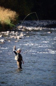


Fishing regulations in Summit County
BLUE RIVER
This gold medal fly fishing river begins at the top of Hoosier Pass just south of Breckenridge, and flows 45 miles through Summit County along Colorado Highway 9.
Rules an regulations are as follows
• From the north inlet at County Rd. 3 (3 miles north of Breckenridge) downstream to the Colorado River, excluding Dillon Reservoir an Green Mountain Reservoir, upstream to the first Colorado Highway 9 bridge:
1. artificial flies and lures only.
• From the north inlet at County Rd. 3 (3 miles north of Breckenridge) downstream to the Dillon Reservoir:
1. Bag and possession limit is 2 fish
2. Minimum size for trout is 16 inches long
3. Fishing is prohibited Oct. 1 – Jan. 31.
• From the Dillon Dam downstream to Silverthorne’s northern city limits:
1. All trout must be returned to the water
immediately.
• From Silverthorne’s northern city limits downstream to the Colorado River, excluding Green Mountain Reservoir:
1. Bag and possession limit is 2 fish
2. Minimum size for trout is 16 inches long
• From Green Mountain Reservoir upstream to the first Colorado Highway 9 bridge over the Blue River:
1. Snagging kokanee salmon permitted from Sept. 1
to Dec. 31.
Fishing License Fees
Summit County Fishing License FeesLICENSE FEES
Resident Licenses
Annual…………………………………………………………………………$20.25
Combination Fishing and Small Game…….$30.25
(If born after 1948, you must show hunter
education card first)
Senior Annual Fishing…………………………………………$10.25
Non-Resident Licenses
Annual…………………………………………………………………………$40.25
Available to resident and non-resident
Five-Day license……………………………………………………..$18.25
One-Day license………………………………………………………$5.25
Second Rod Stamp………………………………………………$4.00
Costs include a 25 cent search and rescue fee
Licenses can be bought at:
• City Market in Breckenridge
• Walmart in Frisco
• Gart Sports in Dillon
FREE FISHING DAYS
You can fish in Colorado without a license only on the first full weekend in June, each year. All other rules and regulations apply. Open to residents and non-residents.
For more information on fishing and regulations, contact:
Colorado Division of Wildlife
6060 Broadway
Denver, CO
(303)297-1192
www.wildlife.state.co.us
Fish found in Summit County
Cutthroat: (Native) Trout: Cutthroat have a crimson slash on either side of the throat beneath the lower jaws. The greenback cutthroat trout is Colorado’s official state fish.
Brown Trout: Spotting pattern is made up of black spots and red-orange spots inside light blue circles.
Rainbow Trout: Identifying marks are black spots on a light body and red stripe along sides.
Brook Trout: Pectoral, pelvic and anal fins often orange, edged with black and white. Body is dark with white and red spots inside blue circles.
Kookanee Salmon: At the end of their third summer, females develope a red-gray-white pattern. Males develope hook jaw and turn brick red.
Lake Trout:(Mackinaw): Has a white, irregular spot pattern on dark body. Veriform markings over back and head. Unlike other trout, they have a deeply indented tail fin.
Lower Cataract Lake
Directions to Lower Cataract Lake: Take highway 9 north out of Silverthorne for 16.5 miles. Turn left on Heeney Road #30. Continue for 5.4 miles to County Road 1725 and turn left. The parking area is 2.6 miles ahead. An ideal spot for fishing, hiking, and picnicking! Walk around the lake (2 mile roundtrip) to the falls and Cataract Creek at the far end of the lake. The falls drop 300 feet down the cliffs to the creek. Fishing is often best where the creek flows into the lake! This is an ideal spot for the whole family to enjoy
How to Catch’em! Spinners of all varieties have proven effective although dry flies fished close to shoreline near submerged logs are often best. Try the far end of the lake for the evening hatches. Sneak quietly around the shoreline as the fish seem to get spooked very easily here!
Black Lakes
Directions to the Black Lakes: Take I-70 west from Silverthorne to exit #190 (first exit past Copper Mountain and route 91). Turn left and cross over I-70 and make an immediate right to the lakes directly ahead. Park at the convenient lot between the two lakes.. The rainbow trout in the upper lake seem to like attractor flies and Panther Martin spinners. Those who are truly desperate to land a fish might stoop to power bait but the Summit County Explorer staff has nothing but contempt for such anglers!
What you will catch: Rainbow trout are the most common catch here. The lake provides ample shoreline for family outings with the western shore of the upper lake often yielding the most action late in the day. The experienced angler will want to try the challenge of the less accessible southern and eastern shores.
Flyfishing on the Blue River
The Blue River is quality freestone and tail-water fishery consisting of brown, brook, and the enormous rainbow trout found below Dillon Reservoir. Beautiful pools, deep runs, and classic riffles characterize the river from Dillon Reservoir to Green Mountain Reservoir. Boulders, bends, and depressions in the river bottom account for the variety of seams and excellent holding habitat for the trout. The river averages from 80-100 feet across, flowing through the Gore Mountains to the Colorado River near Kremmling. This “Gold Medal” fishery provides a good food source and consistent quality hatches. From Breckenridge to Silverthorne, above Dillon Reservoir, is a freestone fishery. Below the Reservoir, is a tail-water fishery where monster trout feast on the thousands of mysis shrimp spilling out of dam. Keep in mind that fish caught in the town of Silverthorne must be released immediately. Please check restrictions before going out. Colorado Highway 9 runs parallel to the river all the way to Kremmling, which provides ample access to this fine fishery. Several National Forest easements, clearly marked by Division of Wildlife signs, access the river. Quality angling can be found all the way to where the Blue meets the Colorado River.
Green Mountain Reservoir
Green Mountain Reservoir is located at the north end of Summit County just below the small town of Heeney. Here you will find rainbows, browns, lake trout, and kokanee salmon. To get there head North on Hwy 6 toward Steamboat from Silverthorne. You will reach Green Mountain Reservoir in about 30 miles.
Snagging for kokanee is permitted from Sept. 1 – Dec. 31
Anglers are catching Lake trout, and Kokanee salmon weighing between 20 and 30 lbs.
Green Mountain Reservoir is not only a great place to fish, you can also take your personal water crafts, camp around the lake, and water ski.
Snake River
Flowing through Keystone Resort, the Snake River connects to Lake Dillon at the east side of Swan Mountain near Summit Cove. Most anglers enjoy fly fishing for trout along this pristine Summit County river.
Muddy Creek
Directions to Muddy Creek: For the adventuresome angler who wants to avoid the crowds along the Blue River (some people even fish at the Outlets in Silverthorne!!) take route nine out of Silverthorne to Kremmling. In Kremmling head west on route 40 (about 6 miles) to Wolford Dam. Park here and follow Muddy Creek as it flows out of the dam to some of the best fishing in Grand County (o.k. it’s not Summit Co. but you can get here from there!)
You might want to avoid this area in the heat of the summer since the flies love all kinds of insect repellent and some are large enough to cause unsuspecting angler to levitate! However, the fishing is great!
What you will catch and what lures to use: Try attractor flies with a beaded nymph to catch some of the large rainbows but spinners work well too! This area is one of the best kept secrets locally since many anglers head for the Gold Medal sections of the Colorado that are nearby.
Clinton Reservoir and Creek
Directions to Clinton Reservoir and Creek: Head west on I-70 to the Copper Mtn. Exit – Route 91. Take route 91 past Copper Mtn. about 5 -6 miles until you come to Clinton Reservoir on the left. Park at the parking lot and walk the shoreline of the reservoir to the mouth of Clinton Creek (east).
This is a bit of a trek but the hardy angler will be rewarded with good fishing and spectacular scenery! Cutthroat are abundant at both the upper (eastern) end of the lake and the lower section of the creek. Spinners work well in the lake but anglers who can match the hatch will be rewarded even more!
The Swan River
Located off of Tiger Rd. in the beautiful Swan River Valley, about 3 miles north of Breckenridge, you’ll find the Swan River. The Swan River provides good casting on numerous beaver ponds for small, feisty, mountain brook trout. The Swan begins in the North Fork of the valley an flows approximatly 9 miles to the confluence of the Blue River.
Rules and regulations for the Swan River are as follows:
1. Artificial flies and lures only 2. Bag and possession limit is 2 fish 3. Minimum size for trout is 16 inches 4. From the confluence of the Blue River upstream 3 miles, fishing is prohibited Oct. 1 – Jan. 31.
When fishing the North Fork of the Swan all cutthroat trout must be returned to the water immediately.
Lake Dillon
Lake Dillon is a spectacular high mountain lake (9,000 ft.) and is stocked annually with kokanee salmon and cutthroat and brook trout. And while many anglers are happy fishing along its 26 mile shoreline, you may find that trolling from a boat could prove much more worthwhile. There are many boat launching ramps located around the lake for your convenience.
Colorado Rocky Mountain Day Trips
Mt Evans
More interested in driving to the summit of a fourteener rather than climbing one? This is the trip for you! Exit Interstate 70 at the Mt. Evans exit (252) and follow the signs and route 103 to the 14,260 foot summit.If you don’t like hairpin turns, dizzying heights and a lack of guardrails this may not be the venture for you! As you drive your way up the mountain, keep a look out at the fantastic scenery and for numerous wildlife that make their home in this area… just be sure to keep your eyes on the road as well!
Want to pan for gold? Interested in the history of many silver mines? Want to take a trek deep underground and see for yourself?
Phone: 970.453.4405
0542 French Gulch Rd. in Breckenridge, offers guided tours that take you more than 1,200 feet underground in an authentic late 1800′s mine.
Mining exhibits, and a chance to pan for gold add to this educational and fun filled experience!
Country Boy Mine Breckenridge Sleigh Rides PO Box 8569 0542 French Gulch Road Breckenridge, Colorado 80424
Glenwood Caverns Adventure Park, located just 80 minutes west of Summit County, offers fun for the whole family: tram rides, cave tours, thrill rides, gemstone sluice box mining, a climbing wall, bungee trampoline, mechanical bull, train ride, mountain-top restaurants, souvenir shop, and more. IRON MOUNTAIN TRAM
(800) 530-1635
A state-of-the-art European pulse-gondola design, one of the first ever installed in the US, takes visitors to the Glenwood Caverns Adventure Park. Visitors experience a towering panoramic view of the spectacular Rocky Mountain scenery as they skim over treetops, up to the top of Iron Mountain and the entrance to Glenwood Caverns and Historic Fairy Caves.
The 4,300-foot-long tram ride originates at Iron Mountain Station located in Glenwood Springs, Colorado. Visitors of all ages enjoy the seven-minute scenic ride inside six-person fully enclosed gondolas with large clear windows. Wheelchair accessible.
Cave Tours:
Located at the top of Iron Mountain in Glenwood Springs, Glenwood Caverns & Historic Fairy Caves offers one of the leading family cave tours in the country. There are three tours available.
The Cave Tour is a 70-minute guided walking tour appropriate for most people.
The Wild Tour is an extreme three-hour, guided, on-your-belly tour that gives you the opportunity to explore the rarely visited areas of Glenwood Caverns.
The 90-minute, guided Adventure Tour is less strenuous than the Wild Tour and allows cavers to explore new areas of the cave.
ALPINE COASTER
Hop on the Canyon Flyer, Colorado’s only alpine coaster, with individual cars on tracks that race 3,400 feet through the trees and down the mountainside. Ride alone or in pairs. You control your speed as you travel over bumps and waves and around hairpin curves.
WILD WEST WAGON
Wagons Ho! Climb aboard the Wild West Adventure Wagon at Glenwood Caverns Adventure Park and travel back in time to the days when cowboys and Conestoga wagons roamed the mountains. You’ll feel the wagon bouncing on the bumpy trail and the wind rushing by as the narrator describes your journey. You might even duck when you hear bandits approaching. This simulated wagon experience lasts about five minutes and is suitable for all ages. Seasonal attraction. Park will be closed in some winter months; call for
seasonal hours or visit us online.
Dillon Marina
PO Box 1825
Dillon, CO 80435
Phone: 970-468-5100
E-mail: [email protected]
Discover summer fun for the entire family. The Dillon Marina is a full-service marina in Summit County that offers access to beautiful Lake Dillon and world class sailing in Colorado. Boating, trout fishing and mountain recreation opportPropertyies abound. The marina offers boat rentals, sailing instruction, racing regattas and is home to the Dillon Yacht Club, the highest club in North America at over 9000 feet in elevation.
Lake Dillon is the largest lake in the area and offers magnificent mountain vistas, with easy access to the Town of Dillon, shopping, lodging, RV sites, and camping. The Dillon Marina hosts exciting weekend sailing regattas and other boating events for fun and sport. The marina offers a full service maintenance shop with slip and mooring rentals available for short or long term. Motorboats and sailboats are available for exploring the lake, fishing or basking in the summer sun. The lake is home to Brown trout and Rainbow trout. With 26 miles of shoreline, finding a nice secluded spot to cast is not a problem.
The recreational choices in the area are endless. Across from the marina is a trailhead to miles of paved bike paths offering spectacular scenic tours. The surrounding National Forest also provides mountain-biking, rafting, fishing, hiking, horseback riding and camping. Jeep tours on old mountain roads will take you to nearby historical mining towns. Be challenged at one of Summit County’s four championship golf courses. In Dillon, play a set of tennis, or simply take a stroll and have a picnic by the lake. The pace here is easy.
Frisco Bay Marina
Located at the East end of Main St. at
902 E. Main St.
(970) 668-4334
Frisco Bay Marina is a certified clean marina located on the shores of scenic Dillon Reservoir in the heart of Summit County, Colorado. The lake spans 3,300 acres and boasts 25 miles of shoreline surrounded by majestic peaks. At 9,017 feet in elevation, the boating season is very weather dependent, but typically runs from early June to early or mid September. Dillon Reservoir is in a world class for sailing and regattas are held regularly.
Frisco Bay Marina offers:
- A full service marina
- Slips, moorings, racks, and dry storage options
- Old Town and Necky canoe and kayak dealership
- Evinrude/Johnson outboard motor service dealership
- Canoe and kayak rentals
- Powerboat rentals
- Sailboat lessons, rentals, tours and paddleboats rentals
- Lake Dillon Water Taxi
- Bar & Grill
- Marina Park with kids playground (Perfect for picnics!)
- Fiberglass and boat repair
- Sail repair
Leadville Colorado
WEALTH! SCANDAL! TRAGEDY! Take the scenic drive to Leadville (route 91 south off Interstate 70) into the historic town of Leadville Colorado.
Be sure to investigate the captivating story of the Legend of Baby Doe, who following a scandalous love triangle, became the wife of 19th century silver king Horace Tabor. Here amidst the splendor of the Tabor Opera House, Baby Doe knew unimaginable luxury and riches only to see it vanish in the silver crash of the 1890′s.
Visit the Matchless Mine where Baby Doe died lonely and impoverished in the 1930′s. Be sure to visit the Tabor Home first for the full and exciting story of one of Colorado’s most fascinating legends!
Georgetown Loop
Experience an engineering marvel! Take a ride on the famous Georgetown loop and see firsthand how 19th century engineers were able to construct a railroad to tap the silver rich mines of Colorado that had to climb more than 600 feet in elevation in just 2 miles. Originally completed in 1884 you can now enjoy a spectacular train ride from Georgetown to Silver Plume while crossing Devil’s Gate High Bridge. Take exit 232 from Interstate 70 to begin your adventure.
Numerous historic hotels, buildings and shops in Georgetown make this a fun day for the whole family.Be sure to take the optional tour deep down into the nearby silver mine. Hard hats included!
Royal Gorge Bridge and Park
Open every day of the year, the Royal Gorge Bridge is located 12 miles west of Cañon City on US Highway 50, approximately 3 hours from Summit County. Take a walk across (yes you can actually feel the bridge sway beneath your feet…) and enjoy the breathtaking views straight down.
This is truly a fun-filled adventure fit for the whole family. Walking paths and lookouts surround the Gorge both at the top ridge and down at the bottom. Walk across the bridge itself or take take the scenic cable car to either side Top it off with gift shops and restaurants to make this a truly pleasurable experience for all.
Maroon Bells
Combine history and nature’s beauty with a breathtaking drive across Independence Pass to Maroon Bells, one of Colorado’s most photographed sites. Take route 24 south from Leadville to route 82, turning right onto route 82 you will encounter beautiful panoramas and frequent hairpin turns to Independence Pass at 12,095 feet.
Great Sand Dunes National Monument
Directions: From Silverthorne take I-70 west to exit 203 (Frisco/Breckenridge). Take route 9 south to Fairplay where you stay straight at the intersection onto Rt. 285 which continues for 82 miles to route 17. You take a slight left onto route 17 and take a left onto Six Mile Lane Rd.as you come in to Mosca. Six Mile Lane Rd. leads to the Great Sand Dunes National Monument and the visitors center. The total distance from Silverthorne is about 170 miles with a driving time of about three hours.
The Great Sand Dunes National Monument is a geologic wonderland that consists of North America’s tallest sand dunes that rise over 700′ against the rugged backdrop of the awe inspiring Sangre de Cristo Mountains. Thirty nine square miles of dunes backed by six peaks over 13,000″ provide some of Colorado most unique hiking opportPropertyies as well as spectacular scenery. People from all over come to hike, camp, and sled down the steep dunes with make shift sleds and snowboards!
Jeep/ATV Tours and Rentals
Feel the wind blow through your hair while riding in a Hummer, an open top Jeep, or an all terrain vehicle (ATV) on trails that wind throughout the mountain terrain of Summit County, Colorado.
Hot Air Balloon Rides
1-888-468-9280

M
ake your dream a reality with a hot air balloon ride in the magnificent Colorado Rockies. Colorado Hot Air Balloon Rides is owner operated and offers its flights in the South Park Valley located high in the Central Mountains of Colorado.
Mountain Flight Package – 2012 flight season runs from May 26 – October 8
Our Mountain Flights are done in the South Park Valley in the exact center of Colorado. Located between Hartsel and Wilkerson pass this central location allows us to conveniently service passengers from Breckenridge, Keystone, Copper Mountain, Vail, Beaver Creek, Denver, Boulder, Castle Rock, Parker, Colorado Springs, Littleton, Buena Vista, Salida, Cripple Creek and Canon City. Experience the highest altitude hot air ballooning in the country with our launch site being at 9,000 feet MSL. Your balloon adventure will provide you with spectacular 100 mile panoramic mountain views. Prominent scenery may include views of the Continental Divide, Mosquito Range, Sangre De Cristo mountains, Sawatch mountains, Mt. Elbert (the highest peak in Colorado 14,433 ft), Pikes Peak, South Park Valley, Collegiate Peaks, vast rolling hills and Colorado native wildlife.
Many of our Mountain Flight passengers like to parlay their once in a lifetime balloon flight into a full day of adventure in the Colorado mountains. With your balloon ride taking place in the heart of the Central Rockies you are only a short drive from some of Colorado’s other most popular outdoor recreational activities and historical attractions. There are endless things to see and do, from whitewater rafting on the Arkansas River, kayaking, horseback riding, fly fishing, golfing, boating, hiking, biking, touring a gold mine or ghost town, taking a train ride with the Royal Gorge Route Railroad, exploring on a jeep tour or just relaxing in the hot springs.
An afternoon in the Colorado Springs area is a great way to compliment your morning of hot air ballooning. Some activities and attractions include: Pikes Peak Cog Railway, Garden of the Gods, Seven Falls, Cave of the Winds, Manitou Cliff Dwellings, Cheyenne Mountain Zoo, US Olympic complex and the US Air Force Academy.
Wherever your journey takes you we’re sure that your balloon ride with Colorado Hot Air Balloon Rides will exceed your expectations and leave you with a wonderful lifetime memory.
Colorado Hot Air Balloon Rides was part of the NBC Today Show featured segment “Live for Today”. Hot Air Ballooning was ranked #18 of 50 things to do during your lifetime.
Secnic Driving
Scenic Drives
Make Rocky Mountain Resort Management your hub when doing scenic drives of the area. By starting in a central location you can view the most of the beauty the mountains have to offer. The following are some popular drives visitors like to do in our area-be sure to watch for wildlife and be respectful of other drivers.
Copper-Leadville-Minturn Loop
From Frisco, go west on I-70 for 6 miles to the Copper/Leadville exit. This is 91-take 91 past Copper (great place to stop for lunch or do a chair lift ride) on towards Leadville. Just before Leadville, exit 24 towards Minturn. You can detour to Leadville and get some great views of 14,000 foot mountains and enjoy the town’s unique history. Once on 24, you can see the remains of Camp Hale, a military training camp from days gone by. Pass Minturn and turn on to I-70 west which will bring you past Vail back to Summit County and Frisco. Give yourself a good half a day for this drive.
Loveland Pass Loop
From Frisco take I-70 East to the next exit 205 (Silverthorne/Dillon) and exit to the right towards Dillon. This road is HWY 6 which will lead you past Keystone, past A-Basin, to the top of the Continental Divide. This is a great spot to park, take a short walking trail and get some pictures on top of the Divide. From the top, follow the road down Loveland Pass back to I-70. Head West to bring you back to Summit County and Frisco. This drive is less than half a day.
Independence Pass Loop (summer only)
From Frisco, go to I-70 West and exit Copper/Leadville HWY 91. Follow 91 through Leadville to HWY 82. You will see signs for Twin Lakes which is a great picture stopping place. Follow 82 to Aspen by going over Independence Pass. It is a little windy and steep so be sure you are not in a hurry and not afraid of heights! Around Aspen are great views of the Maroon Bells and other mountain peaks. Follow 82 along to I-70 where you will intersect with Glenwood Springs. This is a good place to relax and soak in a natural hot spring. After your soak, drive East an hour and a half back to Summit County and Frisco. This is an all day driving tour after you take in stops for pictures, meals, and hot springs.


