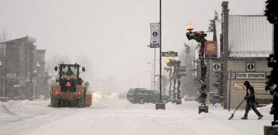
Summit County forecasts calling for a foot or more of snow
“We have a northwesterly flow, with moisture coming off the Pacific,” National Weather Service meteorologist Jim Kalina said. “There’s a really strong jet stream, and that’s favorable for snow in the mountains.”
While the current system will likely favor locations north of Summit County, such as Steamboat Springs, with the most snow, local areas are expected to see up to 9 inches by this morning, another 1-4 inches today and possibly 8 more in some parts of the county by Wednesday morning, according to various forecasts.
“The main cold front will move across Colorado from Tuesday late evening through Wednesday morning,” meteorologist Joel Gratz wrote on his weather blog, OpenSnow.com. “A perfect mix of factors will combine for very heavy snow (cold front, moisture, jet stream) and I would expect road closures on Tuesday night or early Wednesday morning as the front passes.”
Road problems began a little early in Summit County, as conditions deteriorated Monday.
Multiple accidents closed Highway 9 Monday morning, with blowing snow, high winds and snowpack impacting road conditions. No injuries were initially reported, according to Colorado State Patrol, and the highway reopened by lunchtime.
Transportation officials and weather watchers alike warn drivers to expect continuing adverse driving conditions in the mountains over the next few days.
“There will be more icing on bridges and overpasses,” Colorado Department of Transportation spokesman Bob Wilson said. “Ramps can get pretty iced up as well, just because they don’t have the traffic to help with the melting process.”
CDOT plans to run a snow shift, with at least 20 trucks and snowplows out on Interstate 70 around the clock until the storm passes.
The snow has become unstable and reactive, and avalanche experts advised approaching terrain near and above 35 degrees in pitch with care, according to forecasts from the Colorado Avalanche Information Center Monday.
summit daily news


Wow, this paragraph is pleasant, my sister is analyzing these things, thus I am going to convey her.